While visiting the Marbry Mill on the Blue Ridge Parkway near Meadows of Dan, Virginia, I spotted this creature staring back at me. The knotty apparition in the weathered barn wood sure resembled the face of a real Barn Owl.
For comparison, here’s a photo of a real barn owl.
What do you think? Does it look like a Barn Owl to you or perhaps some other creature?
I was hoping for a decent sunrise when I walked onto the dock at Lakeside, Ohio recently. Turns out, my timing and the sunrise couldn’t have been better.
Just as the sun broke the horizon on Lake Erie, the first ferry of the morning slid into view. Sailing north from Marblehead, Ohio, to popular Kelleys Island, the ferry provided an additional center of focus for this shot.
You can see passengers on the upper deck enjoying the gorgeous show. The sunrise alone probably made the price of their tickets more than worthwhile.
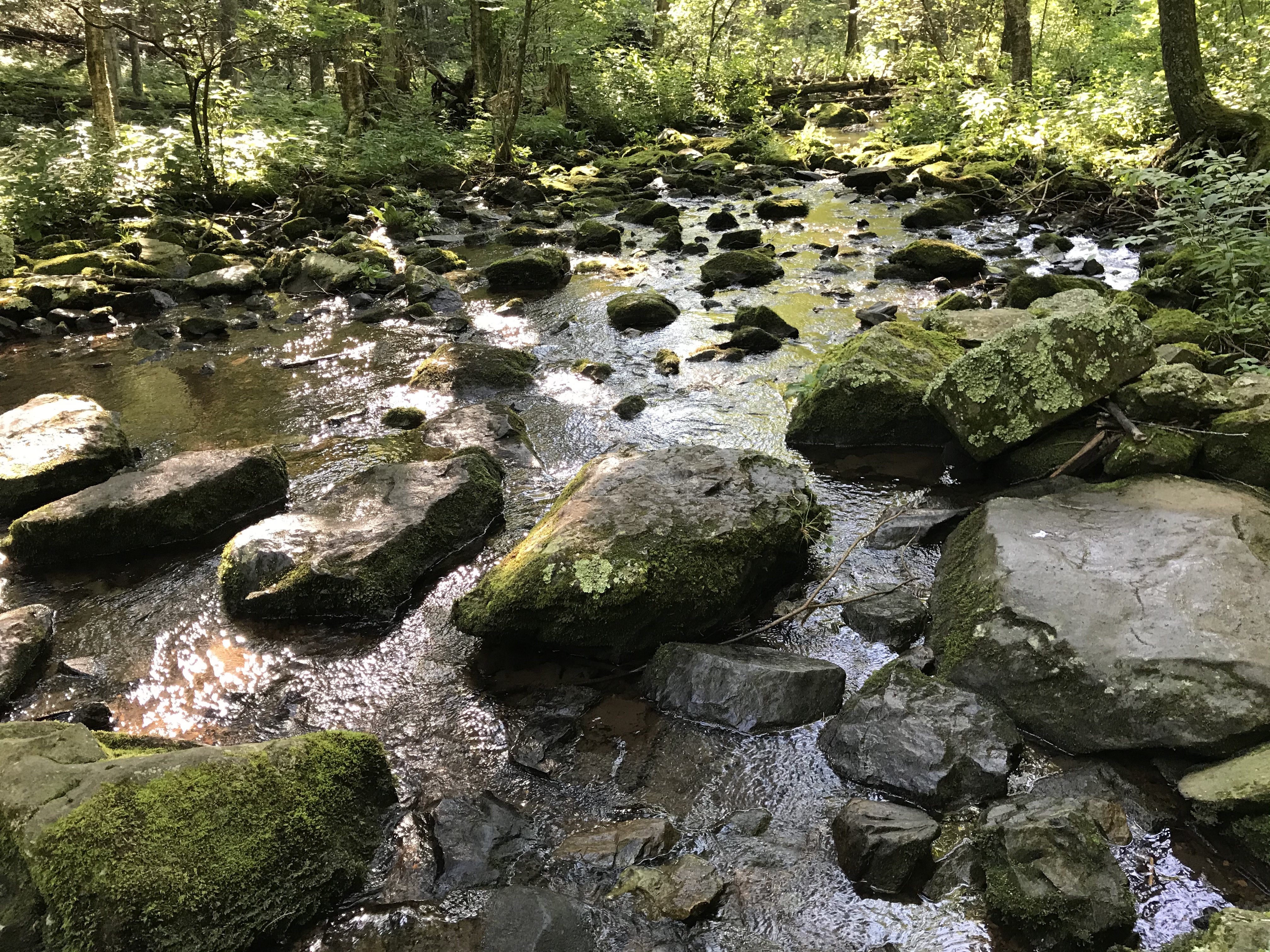
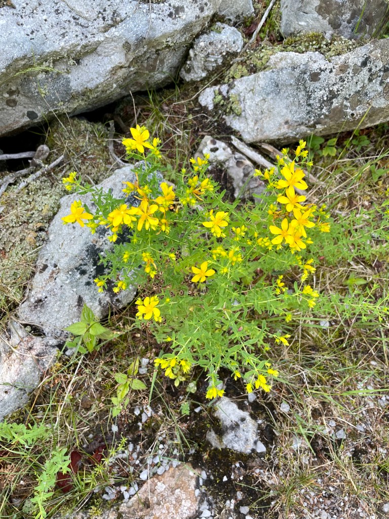
Crossing the Mill Prong on the Mill Prong Trail, Shenandoah National Park.
It had been too long. I missed hiking regularly.
I had several excuses as to why I hadn’t hiked: I was traveling; the weather was too hot and humid; it was too rainy; I had family obligations. I could list more, but you likely don’t want to hear them.
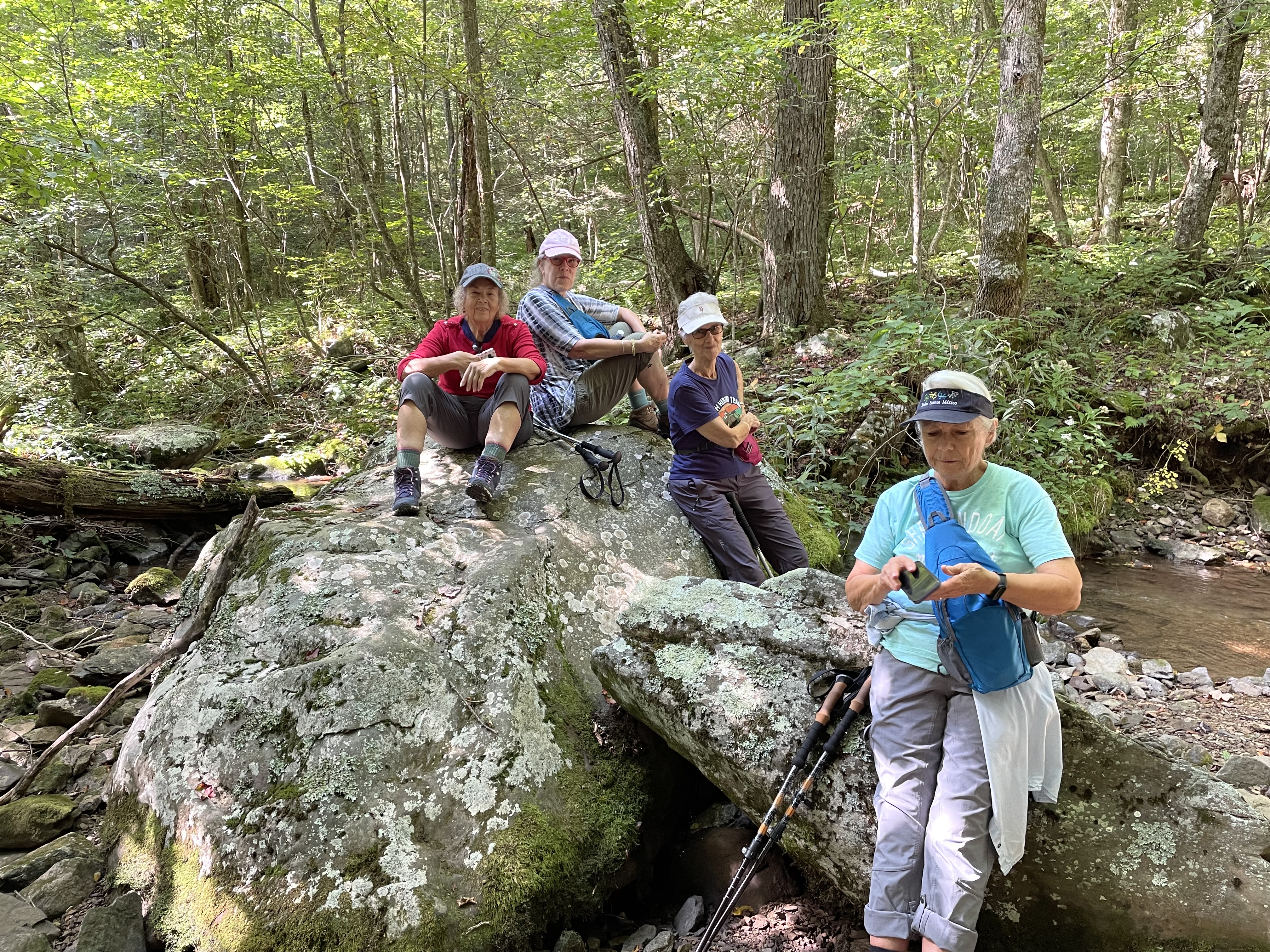
So, I gladly agreed to lead a group when an opportunity to hike came along. A friend and several of her female friends hike local trails weekly. The Mill Prong Trail in Shenandoah National Park was on their radar, but they were unfamiliar with it. My friend knew I had hiked it.
I chauvinistically asked if men were allowed in their hiking entourage, and I was quickly admonished. They wanted to hike and wanted me to lead the way.
The Mill Prong is a side trail that juts off the Appalachian Trail (AT) at mile marker 53 on Skyline Drive in the park. The trail leads to the Rapidan Camp, the summer home of President Herbert Hoover and First Lady Lou Henry Hoover.
My trail app on my iPhone listed it as a moderately strenuous 3.7-mile hike round trip. We wouldn’t be going that far. Since all in our group were in their 70s, our goal was to hike to the intersection with the Mill Prong Horse Trail. That is exactly one mile.
This day was much cooler than the previous weeks of hot, sticky, and sometimes wet days in Virginia’s Shenandoah Valley. When we arrived at the parking lot where the AT crosses Skyline Drive, my van’s thermometer read 60 degrees. It was perfect hiking weather.
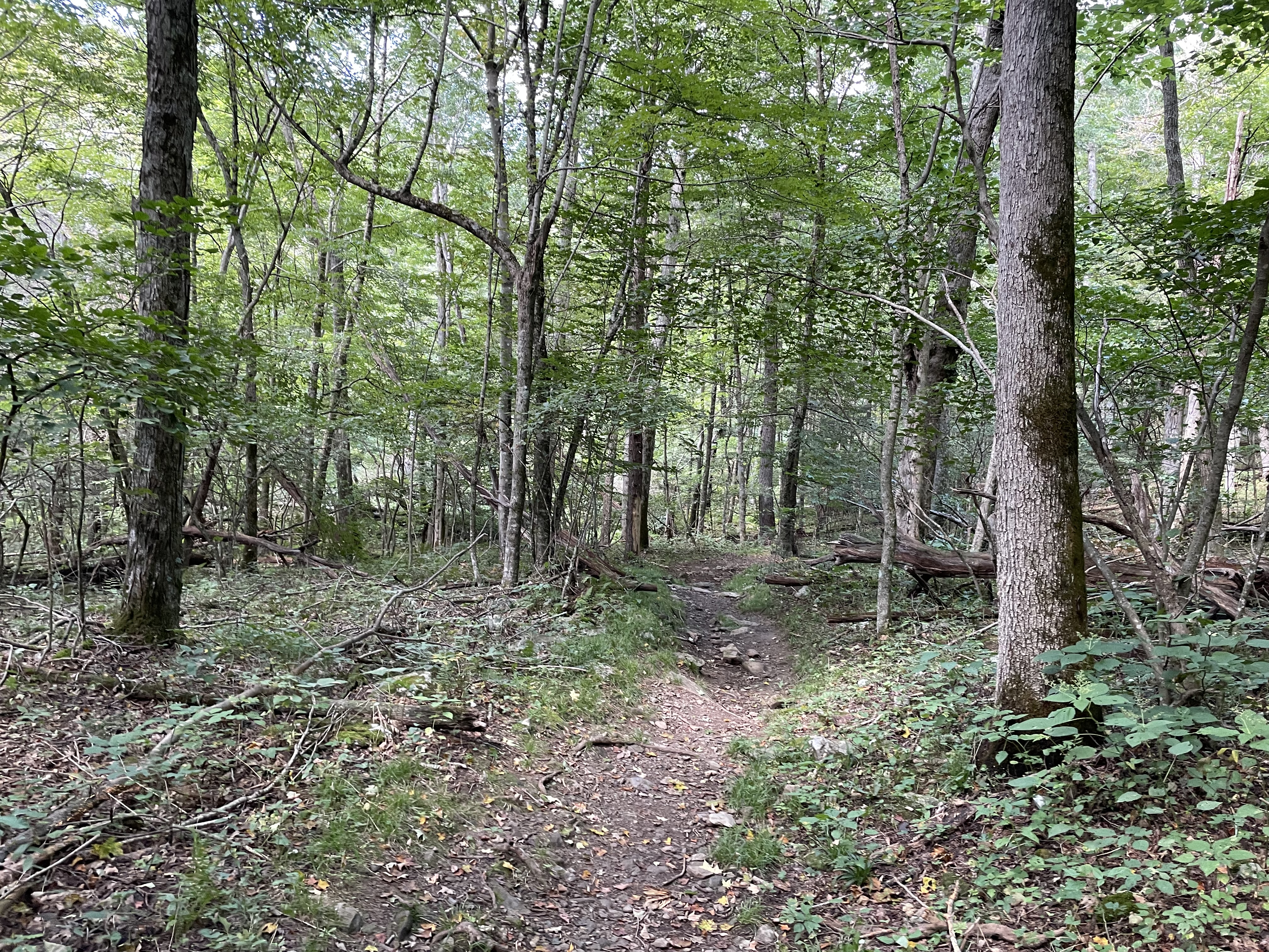
To access Mill Prong Trail, you must walk across the roadway and then a short distance on the AT. Soon you’re at the Mill Prong Trailhead.
I had told the ladies that this wasn’t the most scenic hike. They were more concerned with the trail’s difficulty and elevation gains. Having hiked it previously, I knew that the Mill Prong was a comparatively gradual decline to the horse trail. We had no intention of going to Rapidan Camp. A two-mile roundtrip hike down and back would suffice.
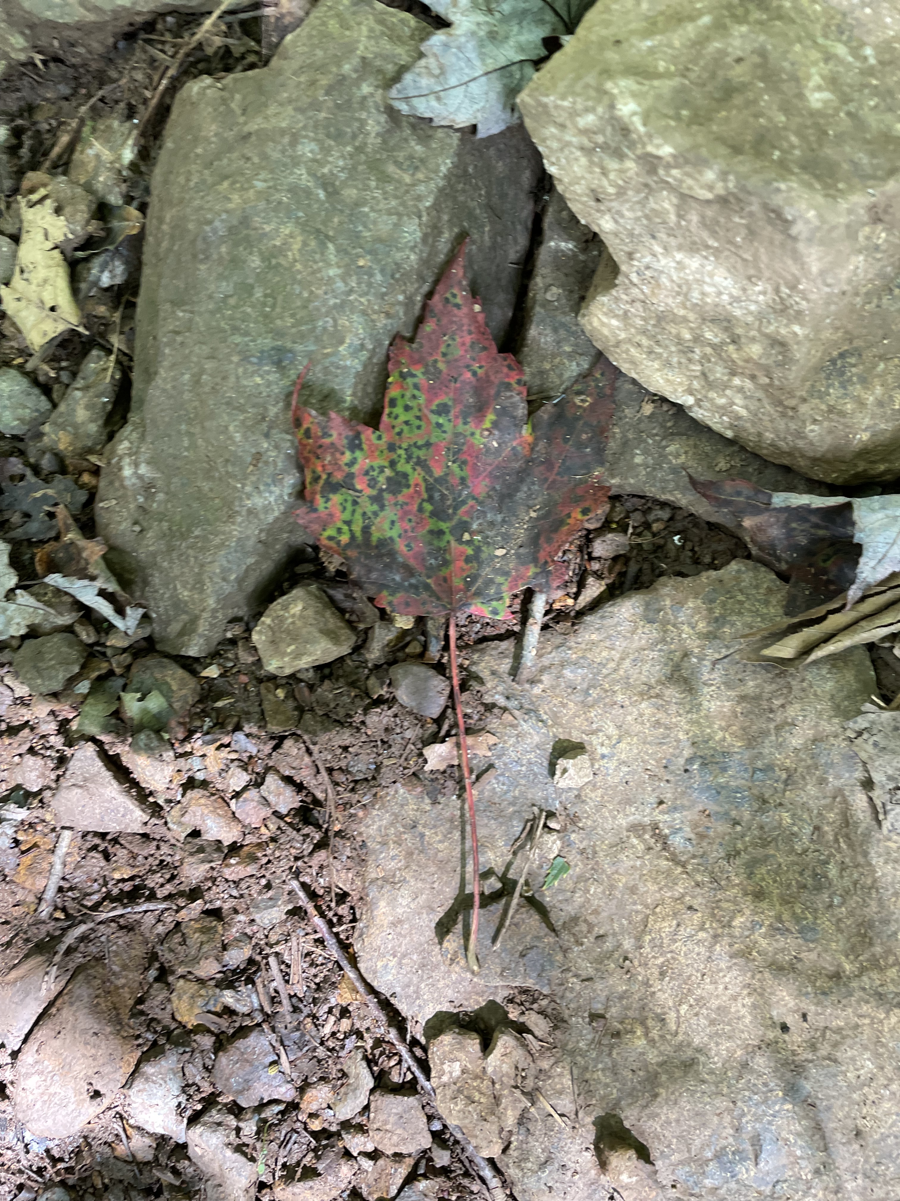
The Mill Prong Trail has two stream crossings. Trail-keepers conveniently placed large rocks for hikers to successfully cross both without getting wet. That is, as long as you don’t slip and fall. I was the only one who did.
The trek down the Mill Prong trail was similar to my earlier experience. The walk was eerily quiet. I only heard a lone Downy Woodpecker along the mostly dirt path down and back. We saw no other hikers until a young woman passed us as we were nearly finished, and she was just starting.
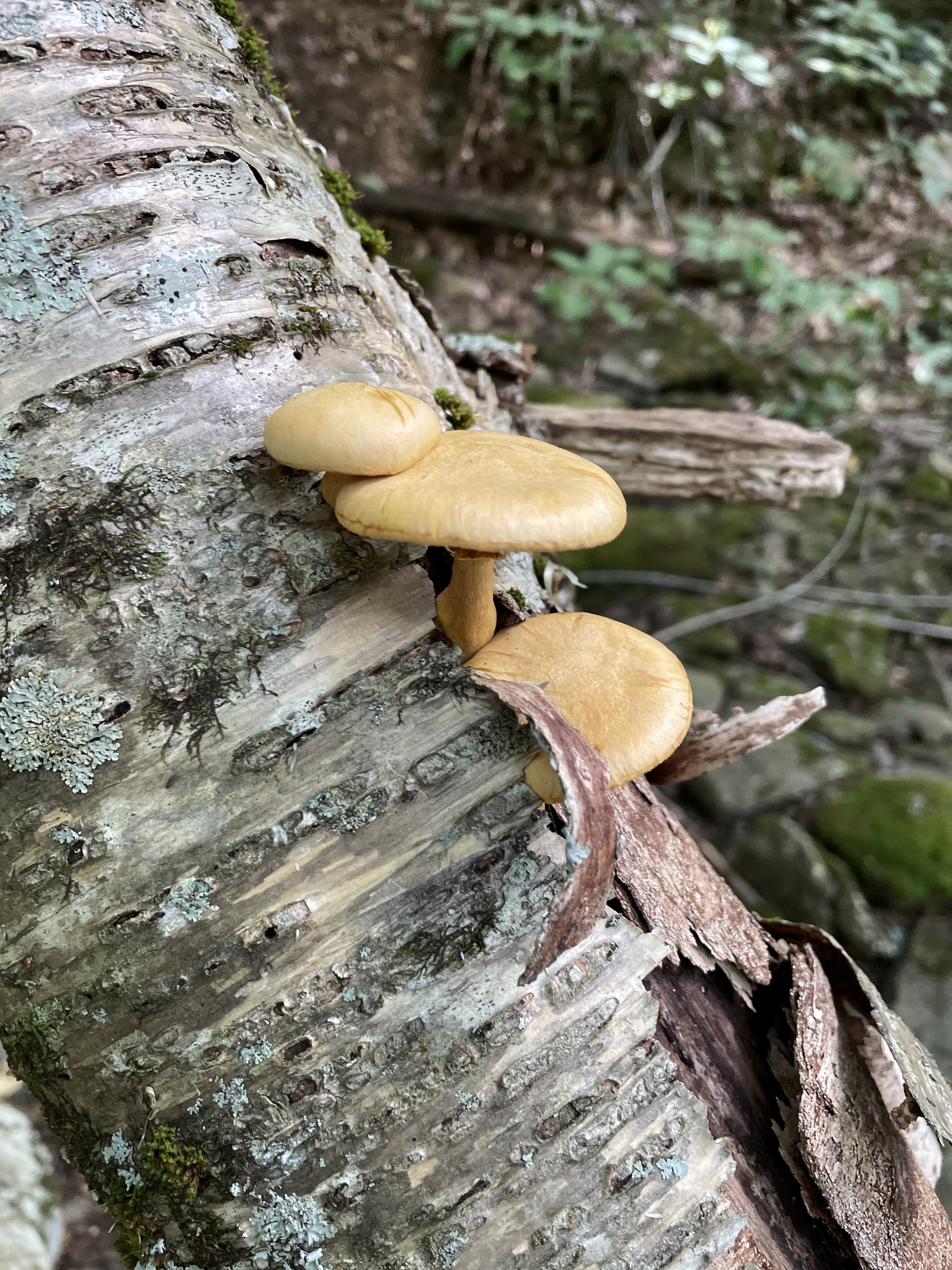
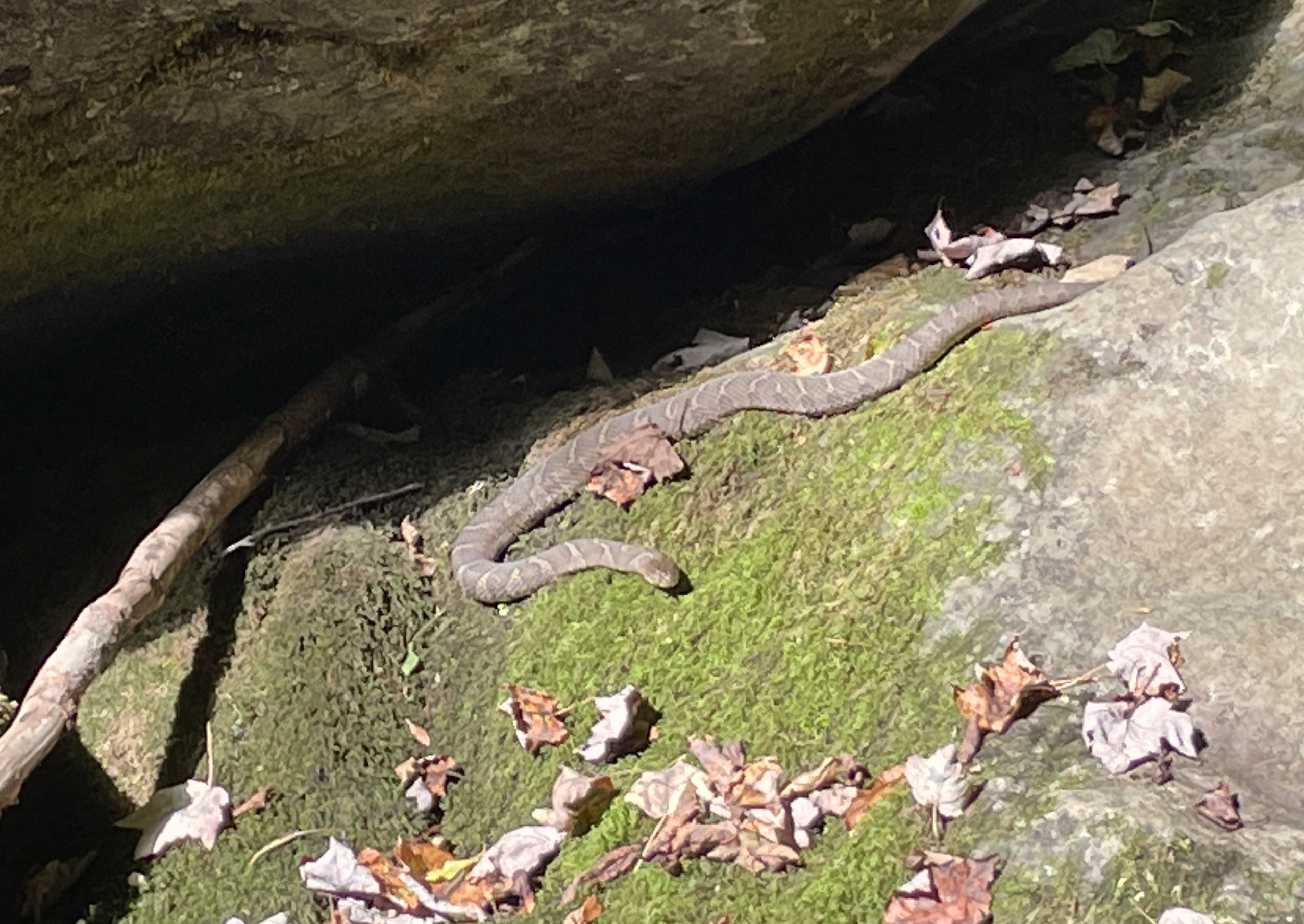
We took our time, enjoying nature’s stillness, the verdant forest floor carpeted with ferns, grasses, and wildflowers. We respectfully observed the colorful fungus and the four-foot northern water snake soaking in the morning sun on a large moss-covered rock in the middle of the trickling stream.
We took a break just after passing the horse trail, precisely one mile from the trailhead. We ate our snacks, inspected the snake, kept our distance, and hydrated.
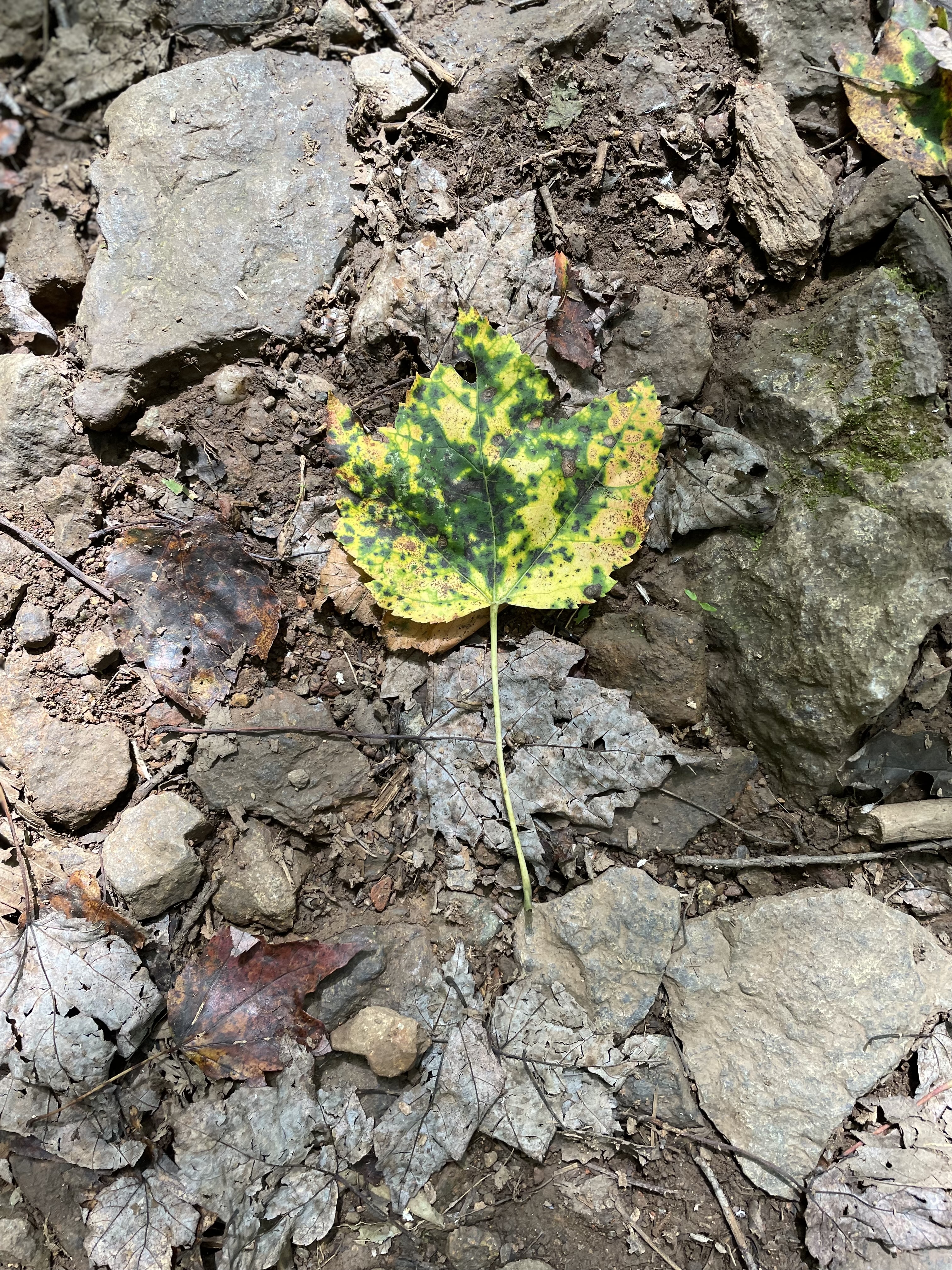
Then it was time to head back up the gradual incline. The trail effortlessly wound its way past outcroppings, back across the two forks of the Mill Prong, shaded all the way by a mixed hardwood forest. It was already shedding some of its leaves.
Just before we reached the intersection with the AT, birds and pollinators began to appear. Jewelweed bloomed everywhere, especially in a triangle between the AT and Skyline Drive. Hummingbirds zipped left and right, and a few Monarchs and Tiger Swallowtails flitted here and there.
Despite our tired old bones, smiles dominated. It was a perfect ending to just the kind of hike the ladies like to take. Me, too.
I was out watering plants and trees last evening since we haven’t had any rain for several days. Suddenly, the western sky turned bright golden.
I quickly wrapped up my watering, grabbed my camera and iPhone, and headed to a close location with an open view to the west. The golden glow had faded. The sun disappeared behind the Allegheny Mountains, but dramatic color remained.
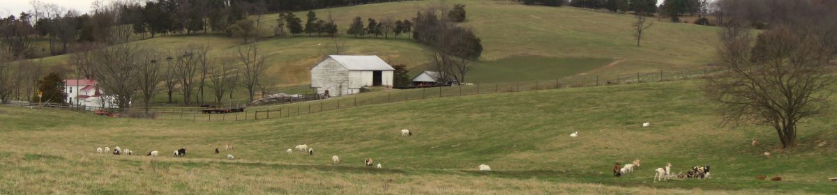
The farmer had already cut the enormous cornfield and had turned loose steers to forage for spilled corn cobs. With Mole Hill to the left and the sunset’s remnants still lingering above the mountains, it looked like a scene out of the old west, not the Shenandoah Valley.
The vista was a beautiful way to close out the first day of September.
I searched for a decent location to photograph the latest lovely sunset in the Shenandoah Valley. I stopped when I came upon this scene of young steers grazing.
The Black Angus scattered in the rolling pasture filled the foreground, while the local landmark of Mole Hill, an extinct volcanic core, dominated the background. The sunset orange-tinted cloud hovered over the Allegheny Mountains in the distance. I imagined old Mole Hill had exploded out of eons of dormancy.
Have you ever intended to photograph one subject and instead captured something entirely different?
That’s what happened to me last evening. I wanted to shoot the full super moon rising over the Shenandoah National Park in Virginia. As soon as I left home, I could see there might be a problem. A large rain cloud hovered over the park, right where the moon was calculated to appear.
Hoping the cloud might move on or dissipate, I kept driving. I am so glad I did.
A full moon always rises as the sun sets. In the Shenandoah Valley, the sun sinks below the Allegheny Mountains that mark Virginia/West Virginia state lines to the west. It rises over the Blue Ridge Mountains to the east.
As I drove east, the last of the day’s sun rays illuminated the clouds over the national park. The closer I got, the more the clouds transitioned from white to peach to orange.
I arrived at my photo destination in time to capture the moment’s beauty. For me, this easily made up for missing the moonrise.
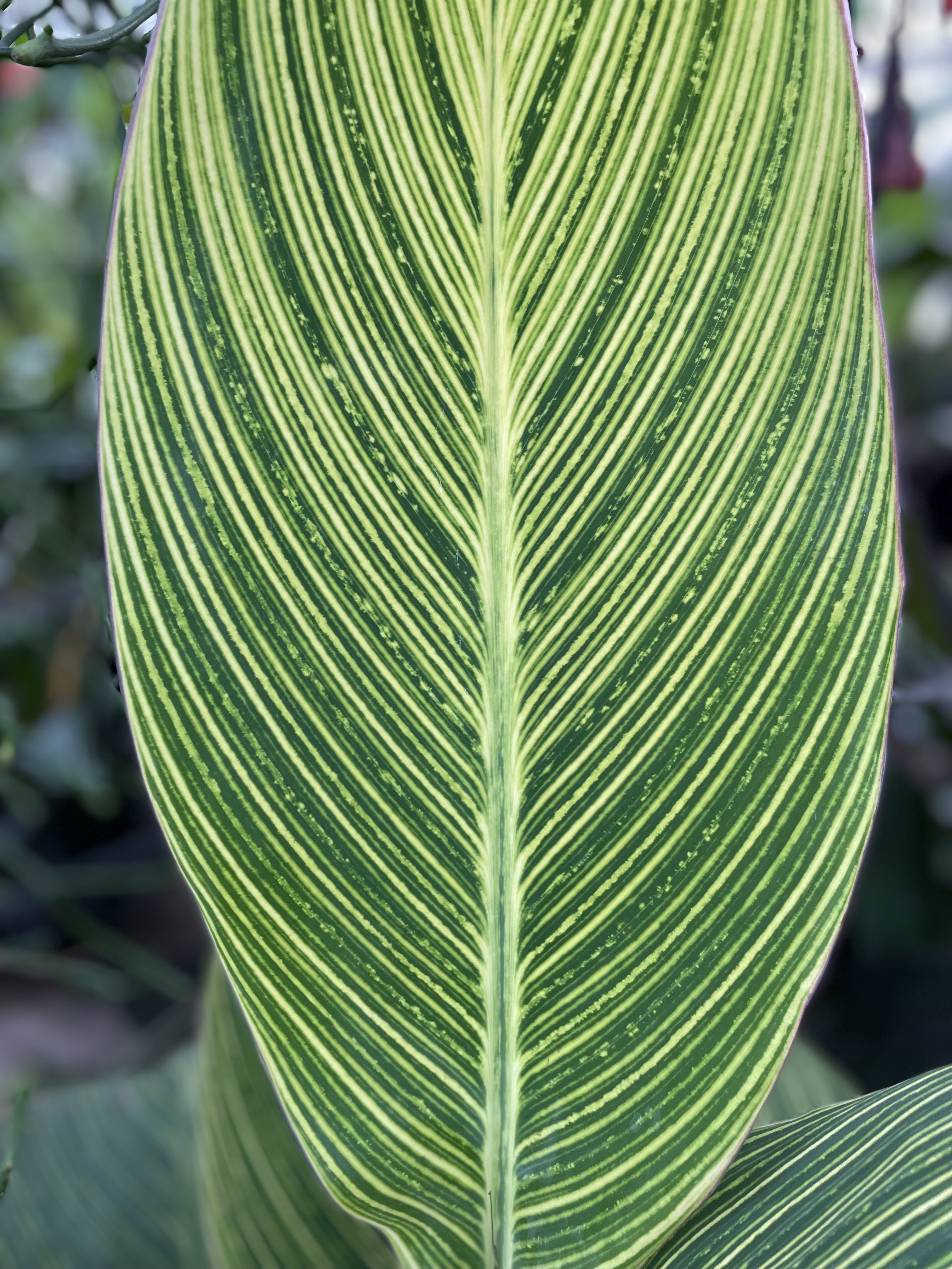
My wife and I recently visited some friends in eastern Pennsylvania. Since we all love flowers, they took us to a local greenhouse that was more like an arboretum.
The wide variety of leaves attracted my attention. The Rising Sun Redbud leaves, however, are from a tree in our backyard.
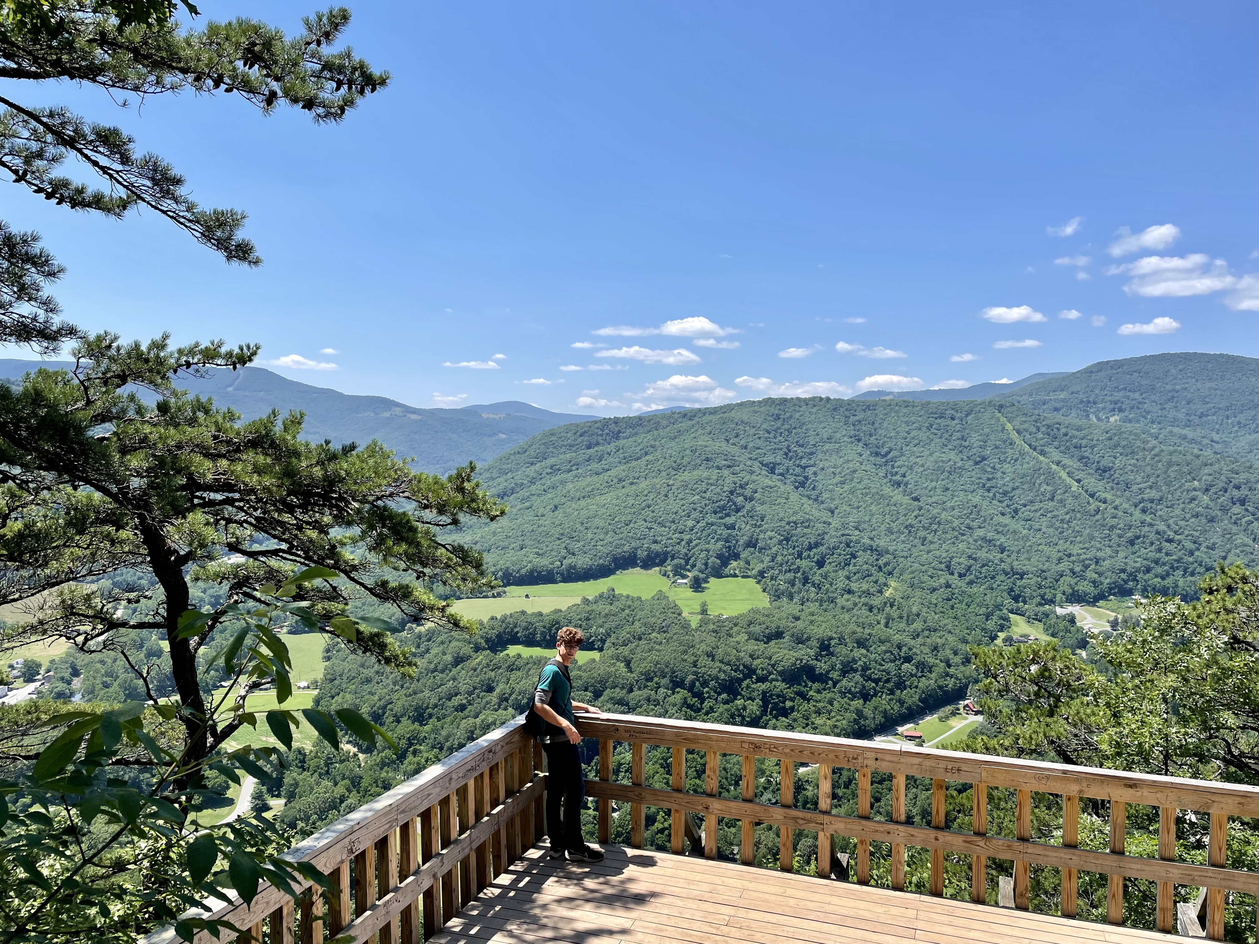
Grandson Davis enjoyed the view from the overlook deck at Seneca Rocks, West Virginia.
Weather nut that I am, I check the forecast regularly. Monday looked to be decent weather for hiking. Cooler temperatures in the higher elevations and no rain. That would work out just fine for several reasons.
Our daughter and her husband had left the previous Sunday to take our oldest grandchild to his college orientation in Richmond, Virginia. Of course, the university had nearly four days of activities for the new students and their parents.
That left the middle grandchild, Davis, and our only granddaughter, Maren, to check on. With them both being responsible teenagers, that didn’t require much.
With school out for the summer, Maren loves to help Nana with puzzles, baking, and other hands-on chores. She also mows our lawn. That left Davis and me to find trouble together.
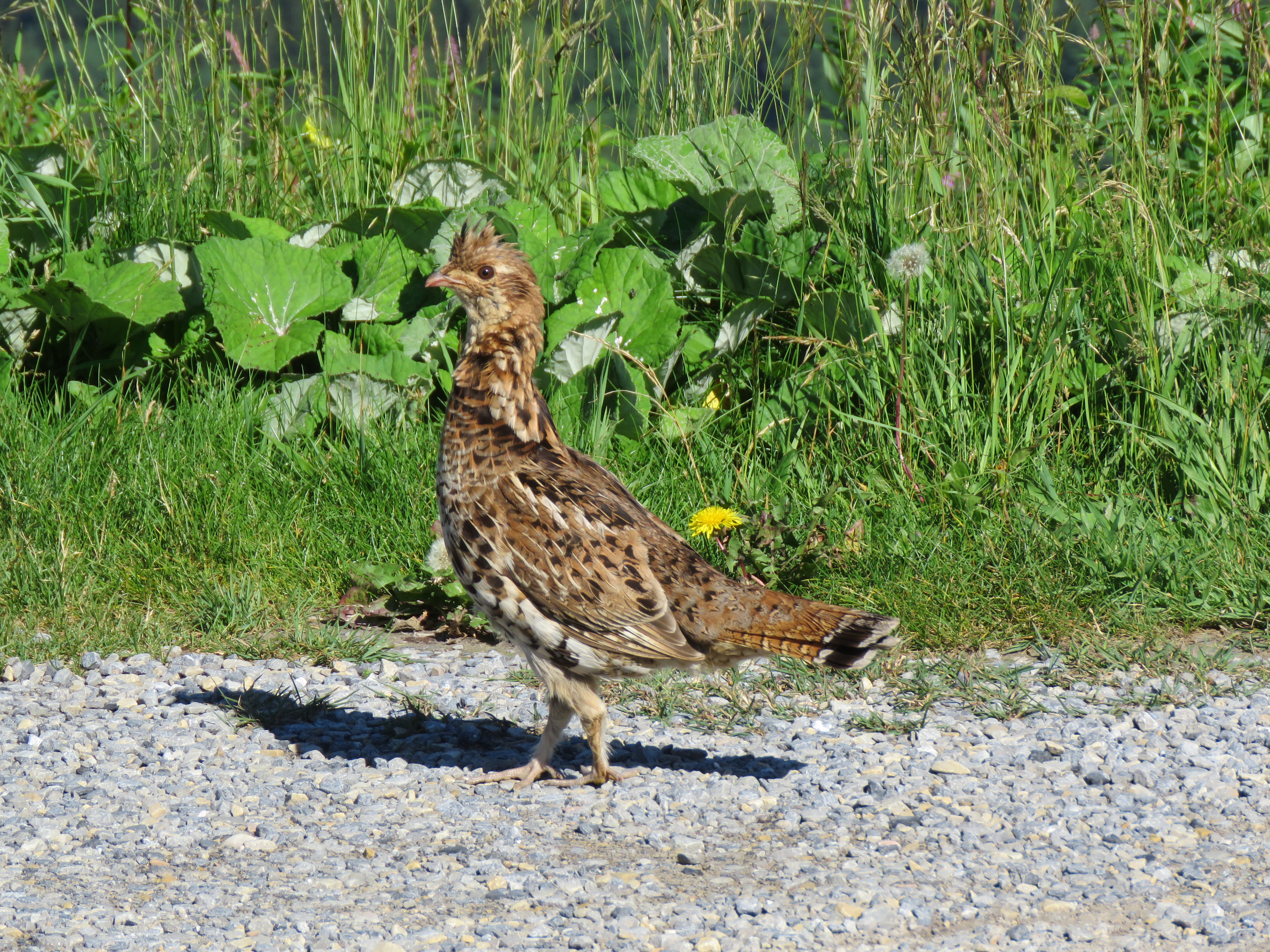
Since we both like to hike, we visited Spruce Knob, the highest point in West Virginia. It’s an hour and a half drive for us. We left mid-morning, but Davis didn’t take long to nod. How he could snooze in all that hilly, twisting driving I was doing, I don’t know. He woke as I slowed to photograph a Ruffed Grouse strutting its stuff on the Forest Service road near the mountain top.
Male Ruffed Grouse.
After taking a few snapshots of this often elusive bird, we were soon in the parking lot. Other than a Forest Service employee, we had the place to ourselves. However, we hadn’t even started on the trail when I realized I had forgotten the insect repellent. Fat flies buzzed nearby, but none landed on us the entire time we were there.
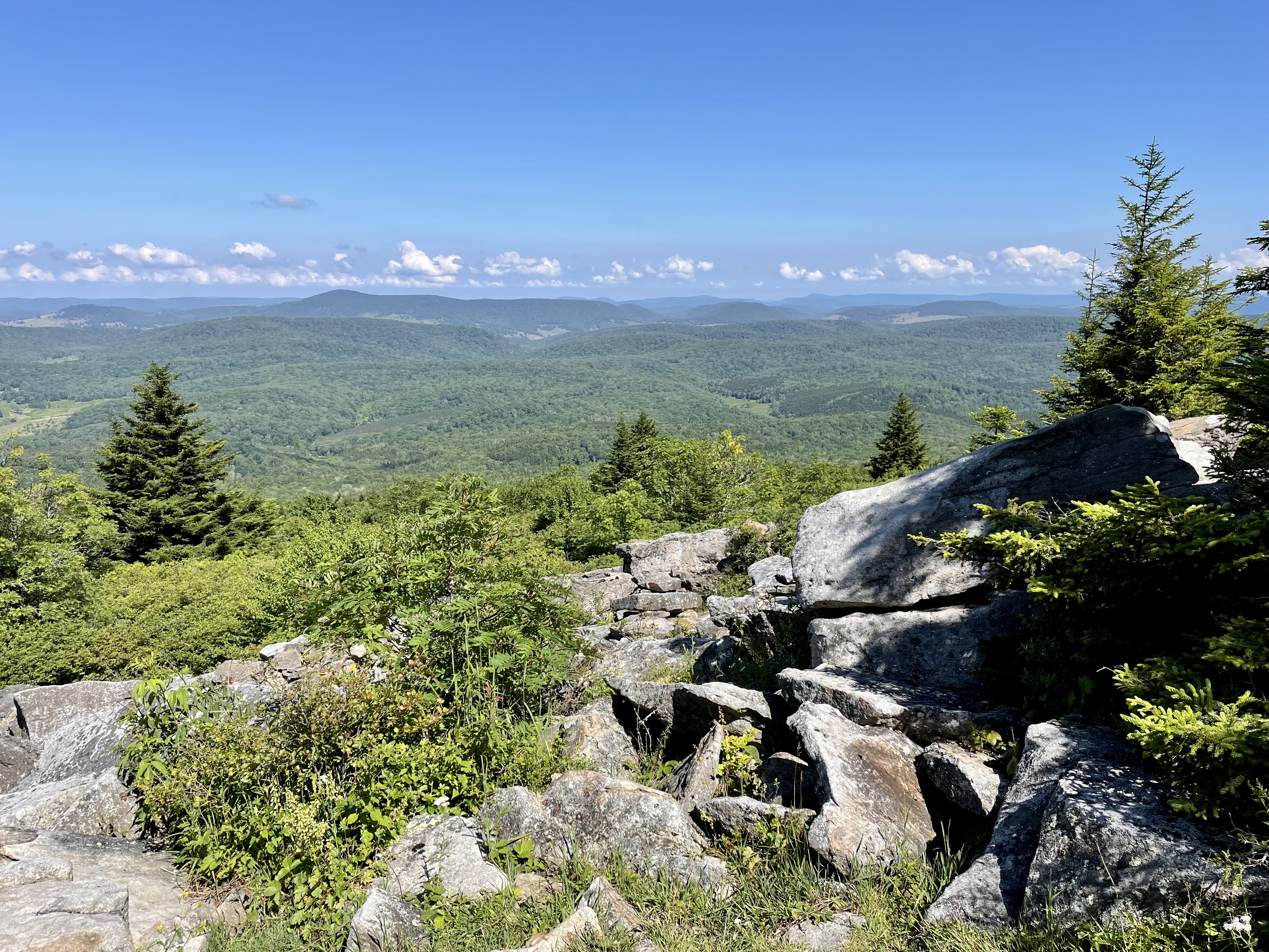
Spruce Knob affords beautiful views on a clear day like today. Only a few puffy clouds formed over distant mountain ranges to the west. The air was a pleasant 66 degrees with little humidity and no haze to obscure our views.
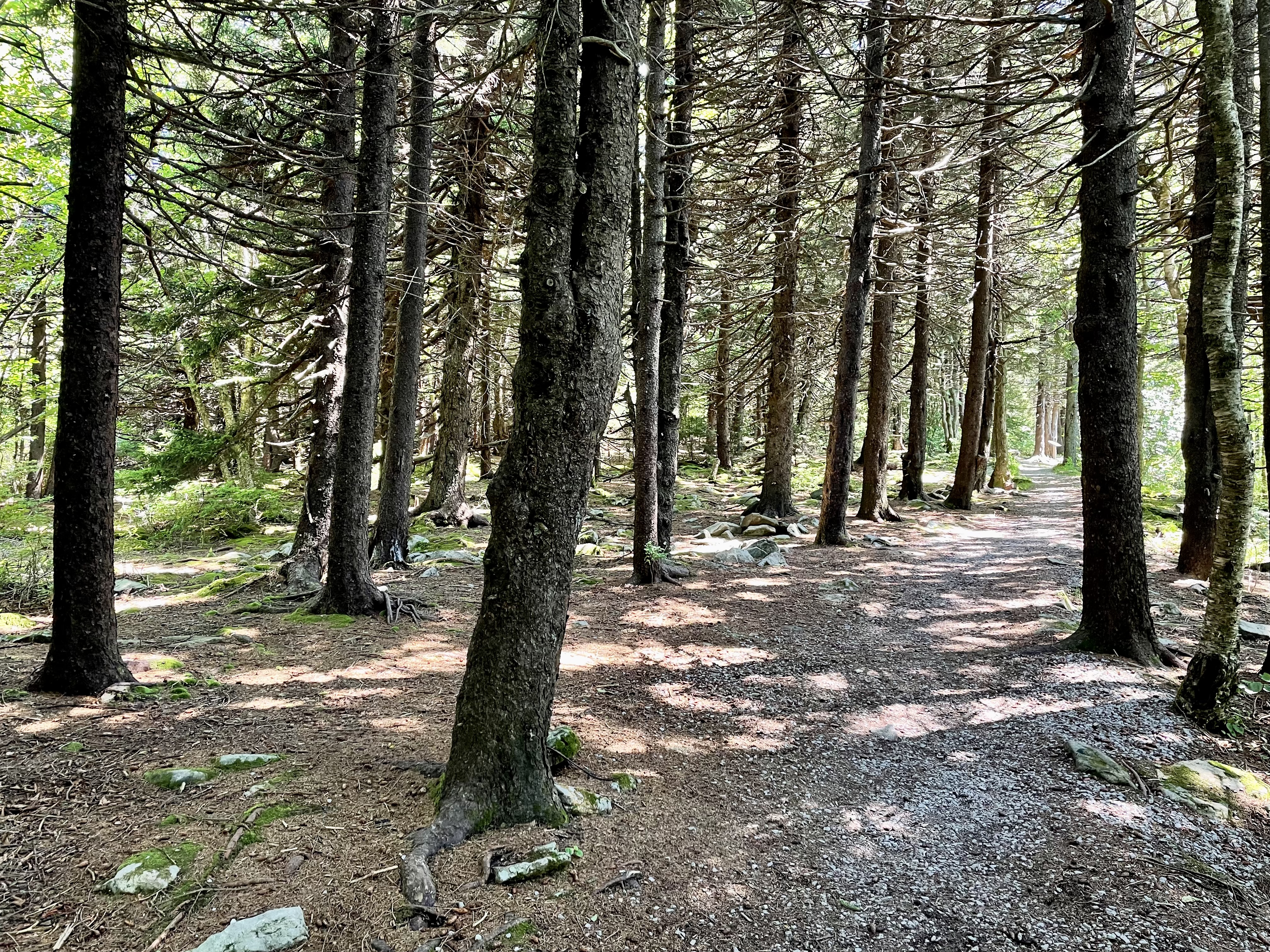
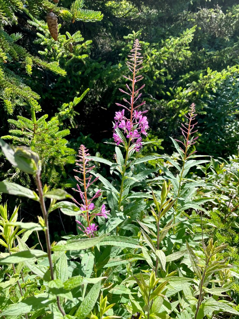
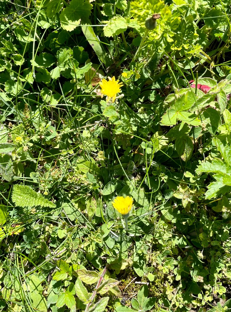
We walked the loop trail that leads from the parking lot and back. The scent of the spruce filled the air. Wildflowers and birdsongs were abundant. We basked in both.
I know I slowed Davis down by constantly pausing to photograph wildflowers, birds, and butterflies. Trooper that he is, Davis didn’t complain.
I wanted Davis to enjoy this trip. It was one he was supposed to do at the end of the school year with several students and six teachers. The trip was canceled at the last minute when three teachers came down with Covid-19. In the end, all six were sick.
They were to camp out and visit Spruce Knob, Seneca Rocks, and Dolly Sods. All were in the same geographic area of the old folded mountains and valleys.
So, while Nana and Maren were enjoying each other’s company, and Davis’s brother and parents were occupied with college orientation, Davis and I explored some of the wilds and wonders of West Virginia.
We studied the large piles of giant rocks along the path and at the slope of the mountain, long ago rounded by millenniums of erosion from wind, water, ice, and snow. The teacher in me quizzed Davis about how the rocks got where they did. He graciously played along with my lame attempts.
We saw migrant birds and birds that should be migrants but reside here year-round. Dark-eyed Juncos commonly nest in Canadian provinces. The exception is the Appalachian Mountains.
Because these beautiful ridges hold the same habitat and provide the necessary nutrients, the birds live here and farther up the Appalachian range into New England. Davis wanted to know why the other Junocs migrated when the birds we saw stayed. I hope he seeks a better answer than I gave him.
We enjoyed the views east and west and headed to Seneca Rocks, where we would eat our brown bag lunches. When we arrived at the valley picnic grounds, it was 82 degrees and humid.
From there, we could clearly see the face of the vertical rocks jutting straight up. Eons ago, they had been parallel until the collision of continents forced them to fracture and face the sky.
Unfortunately, no rock climbers could be seen. The day was likely too hot for such strenuous activity.
We gathered our things and headed up. The trailhead started at the North Fork of the South Branch of the Potomac River. The bridge that crosses it goes by the same cumbersome name.
Davis was eager to let his long legs glide him up the well-maintained trail. My old weathered ones weren’t so cooperative. The first third of the path is the steepest. We rested according to my needs. Davis never complained or barged ahead.
We passed other hikers on their way down, and other younger hikers passed us on the way up. I noticed some of them didn’t have hiking shoes or water. We later trekked by some of those same hikers, now fatigued. We reached the top more than an hour after we had started.
The trail leads to an overlook platform that provides gorgeous views of the mountain ridge west of German Valley that the river continues to carve out. We rested and talked with other hikers who soon reached the summit.
Going down took half the time. Davis wondered about going on to Dolly Sods up the road a piece. I wisely said we would save that adventure for another outing. We still had that long drive home.
Adventures like these are the reason we moved from Ohio’s Amish country to Virginia. Now, with the birth of our fourth grandchild in Rochester, New York, we have additional opportunities to watch our grandchildren grow.
What was supposed to be the last leg of the trip wasn’t.
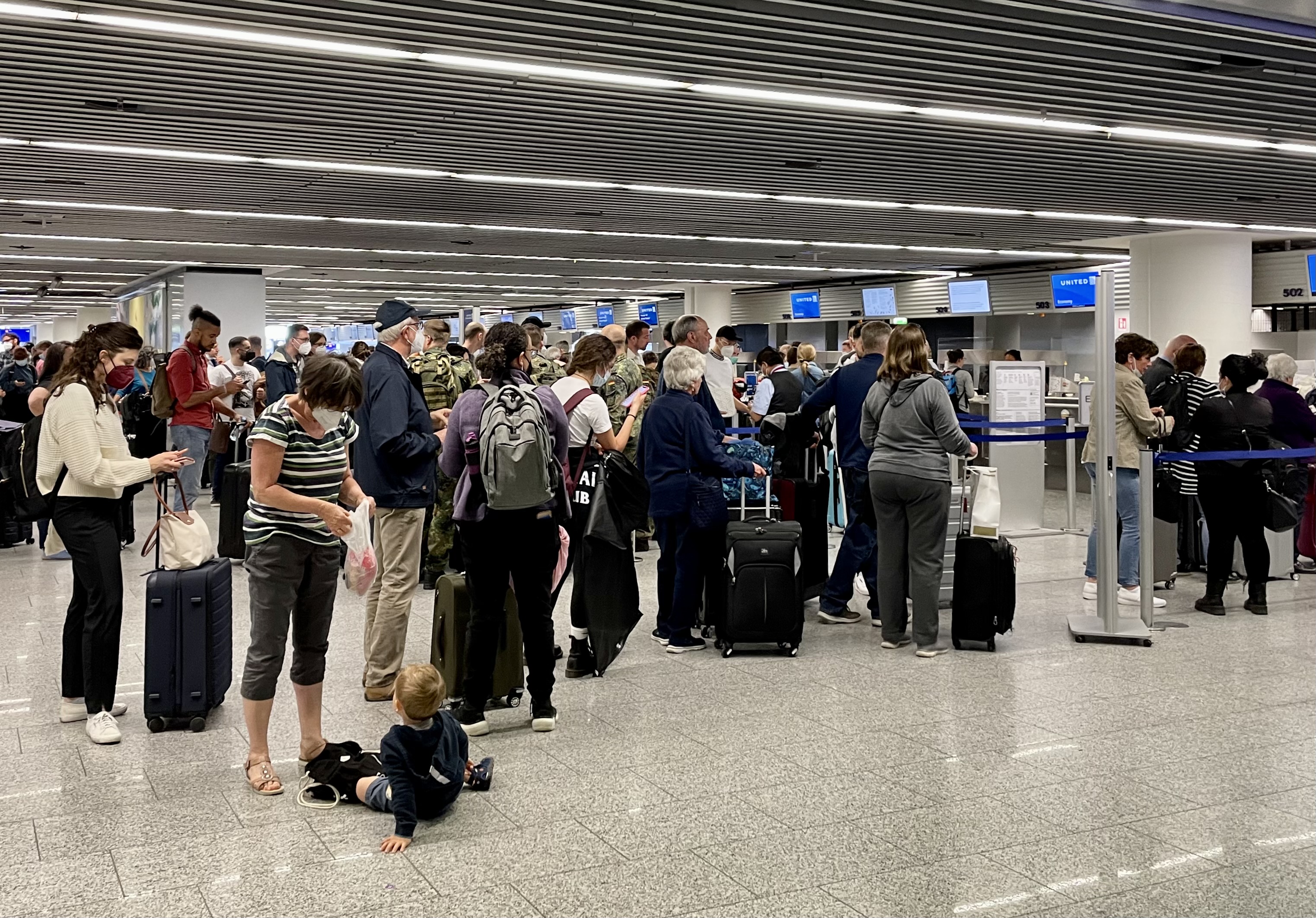
We woke up to the news that our flight home was canceled. Off to the airport, we went anyhow to rebook. It was chaotic at our airline’s booking counters, to say the least. But with a lot of patience on the part of all of us, it all worked out despite being there several hours.
Lufthansa worked with each group member and allowed us to pick our seats. Three members of our group were six feet eight inches or taller and needed lots of leg room. We were also given vouchers for an excellent hotel, dinner that evening, and breakfast the following day.
An advertising mural at the airport.
Reality at the airport
We did have to arrange on our own for yet another Covid-19 test since that requirement was still in place when we traveled. That process was equally chaotic. Though it took much too long, we all tested negative again.
Despite the confusion and frustrations of this day, there was a very positive upside for my wife and me. The open evening allowed us to meet some new friends.
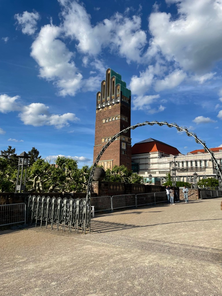
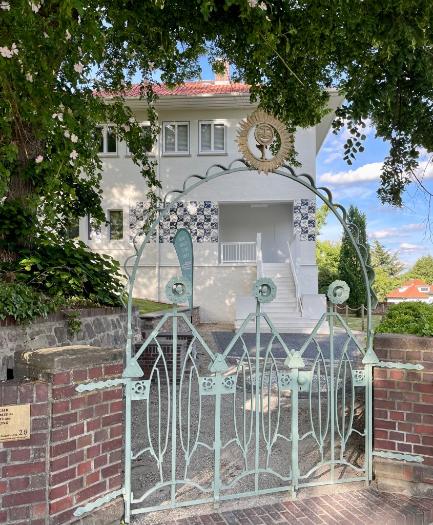
Marie-Helene has followed this blog for a few years. She and her husband Oliver lived near Frankfurt and offered to come to say hello. Now that we had an open evening, they took us to a UNESCO World Heritage site, Mathlidenhohe in Darmstadt.
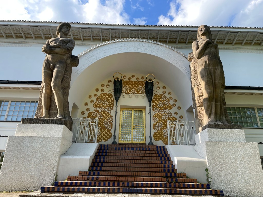
According to the World Heritage Convention, the historic artist colony is at the city’s highest point. The “finger building,” as locals refer to the art nouveau tower, serves as the centerpiece for this most unusual and striking community where much of the architecture is the art.
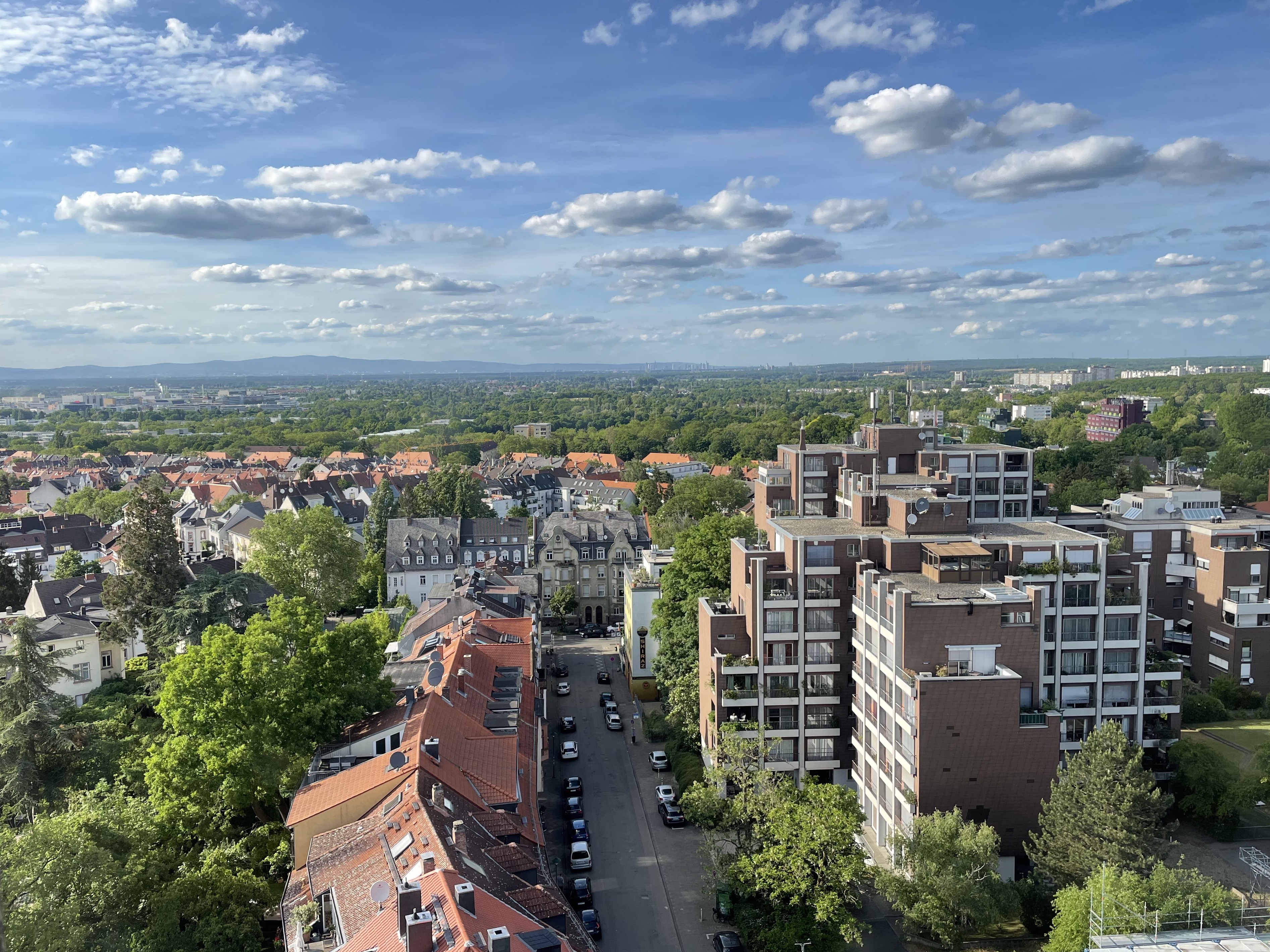
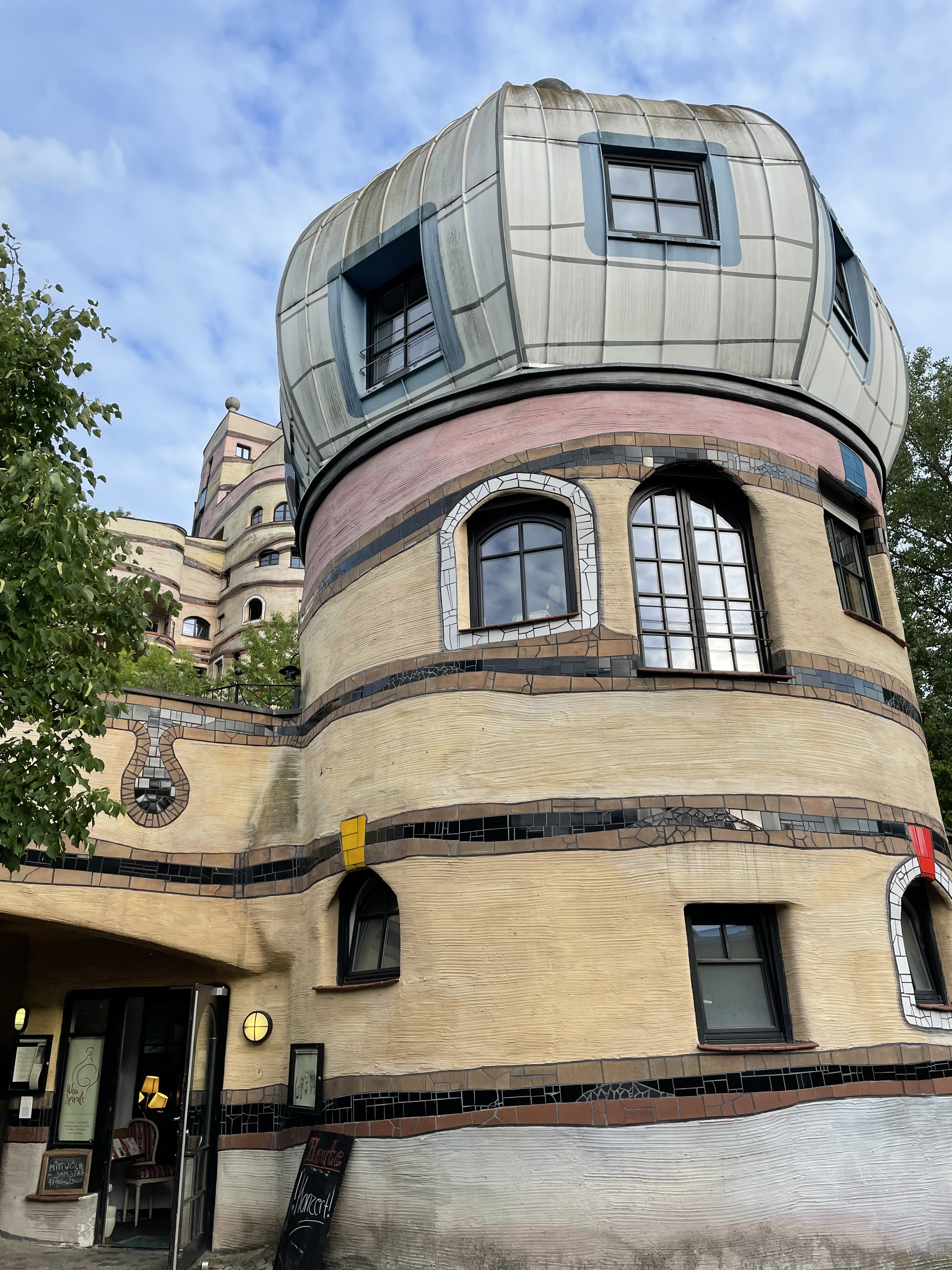
Our hosts led us on a walking tour of part of the area. We climbed the “finger building” that often serves as a wedding venue. From the building’s pinnacle, we had marvelous views of the city.
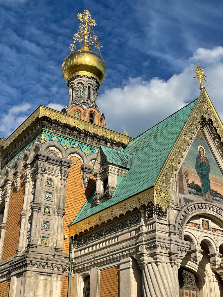
The golden dome of the Russian Orthodox Church reflected the evening sun just below the tower. We saw other public and private buildings that made this neighborhood the artistic wonder it is.
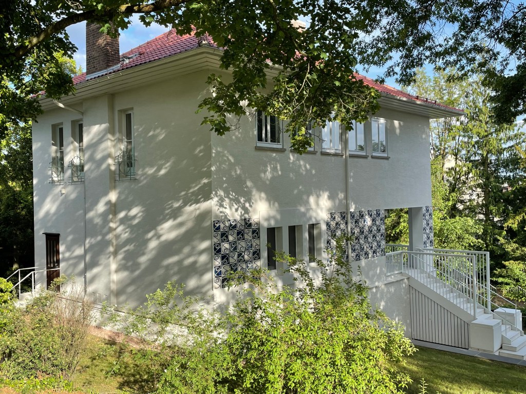
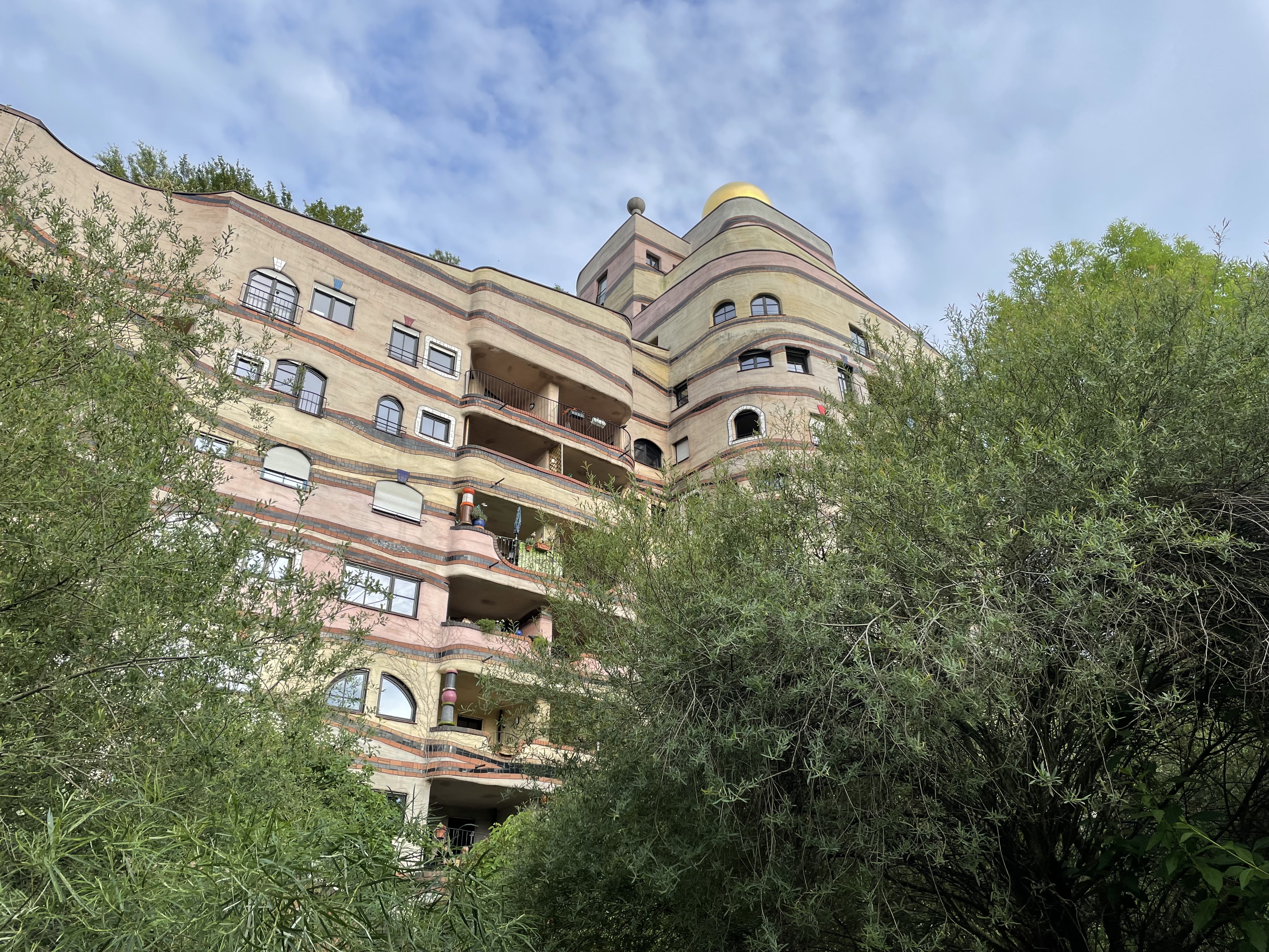
Particularly striking was the nearby Waldspirale. It was a sprawling apartment building that spiraled upward into an expansive structure. Erected in the 1990s, it was constructed so that nothing looked level, but everything was. The building even had a green roof where large trees grew. I found it an astounding piece of architecture.
All too soon, we had to return to our hotel in Frankfurt, where we dined with our friendly hosts. We bid them farewell with hugs and words of gratitude for their kind hospitality.
The next day it was off to the airport and a long flight home. The plane left as scheduled this time, and the flight went well. After gathering our luggage, we had a two-and-a-half-hour ride home, and just like that, our European adventure had ended.
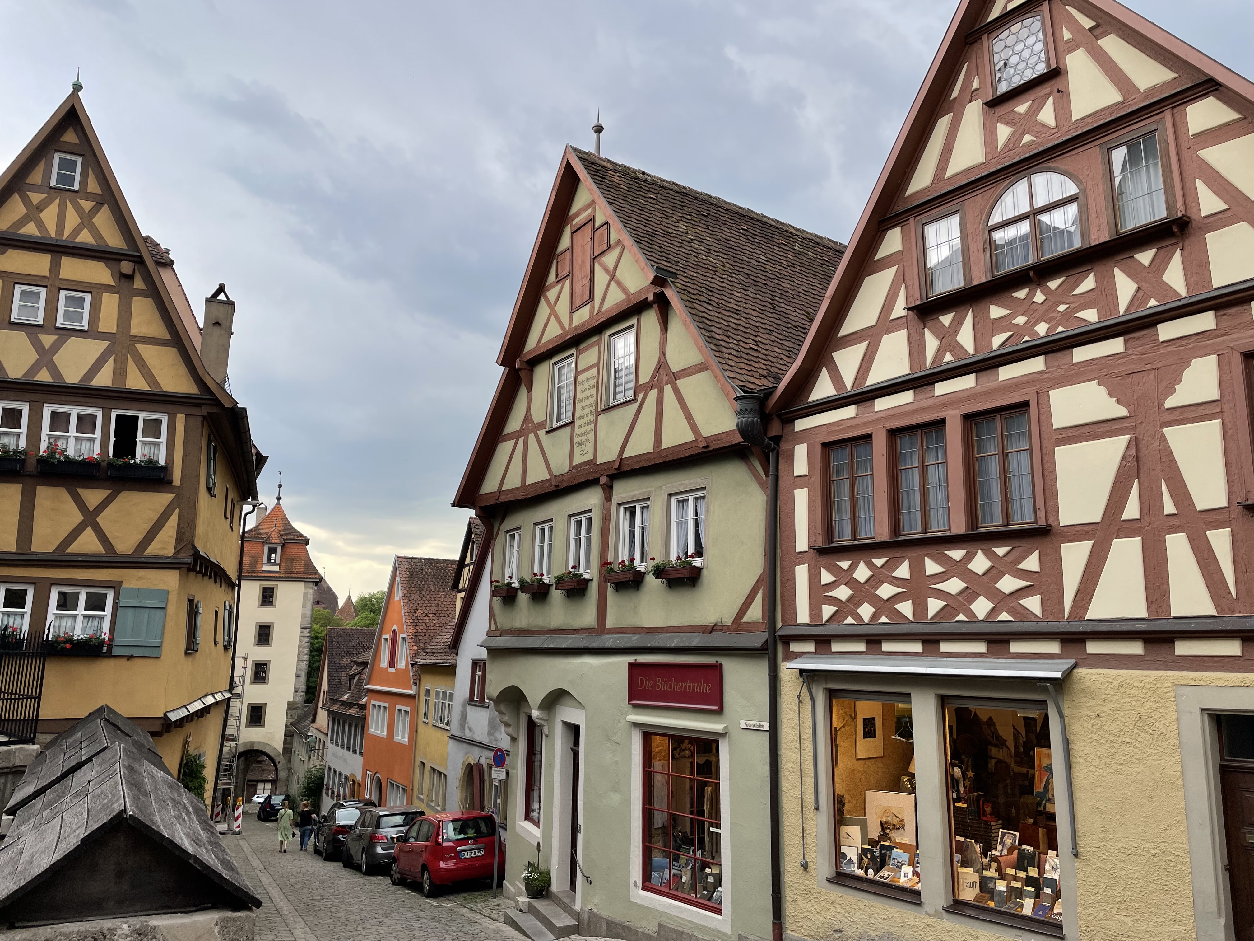
Rothenburg, Germany, is the best-preserved Medieval town in Europe.
Our last full day in Europe was supposed to be one of travel, enjoying a medieval town, and preparing for our flight home early the next day. It didn’t turn out that way.
The plan was to get our required Covid-19 tests before leaving Oberammergau. Unfortunately, a miscommunication occurred, and our 78-year-old tour guide had to scurry around and find testing for our group of 39. She found a mobile testing operation, but there was a problem. Since members of our group were scattered in three hotels, not all the hotels would allow the testers to enter. Fortunately, our hotel was not one of them.
Typical views of Bavarian countryside and a trucker with a sense of humor.
We paid our 40 euros, did the paperwork, got our tests, and waited for our results. In an hour, we learned we were good to go, but others on our tour had to wait and wait for their tests and results. We left close to lunchtime, which put us well behind schedule.
Our excellent bus driver expertly maneuvered us along country roads. We even encountered a closed road with no advanced warning. We had to go several kilometers out of the way on narrow country roads to reach the autobahn.
Sandra, our guide, kept her calm and used her travel wisdom to get us to a proper place for a much-needed lunch break. The highway cut through pristine farmland and along rail lines, biking, and hiking paths. Windmills topped ridge lines, and acres of solar panels occupied areas along the roadway.
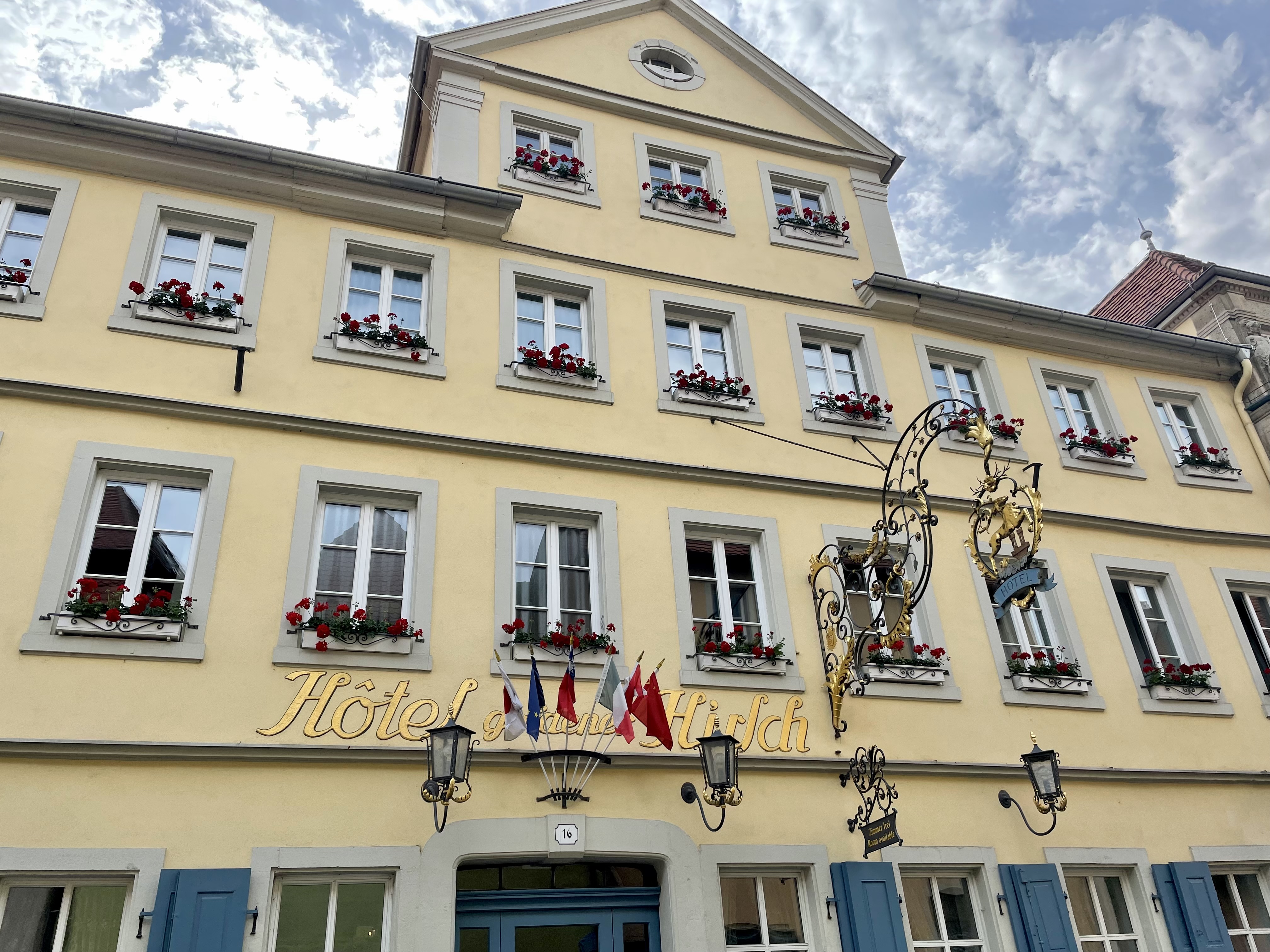
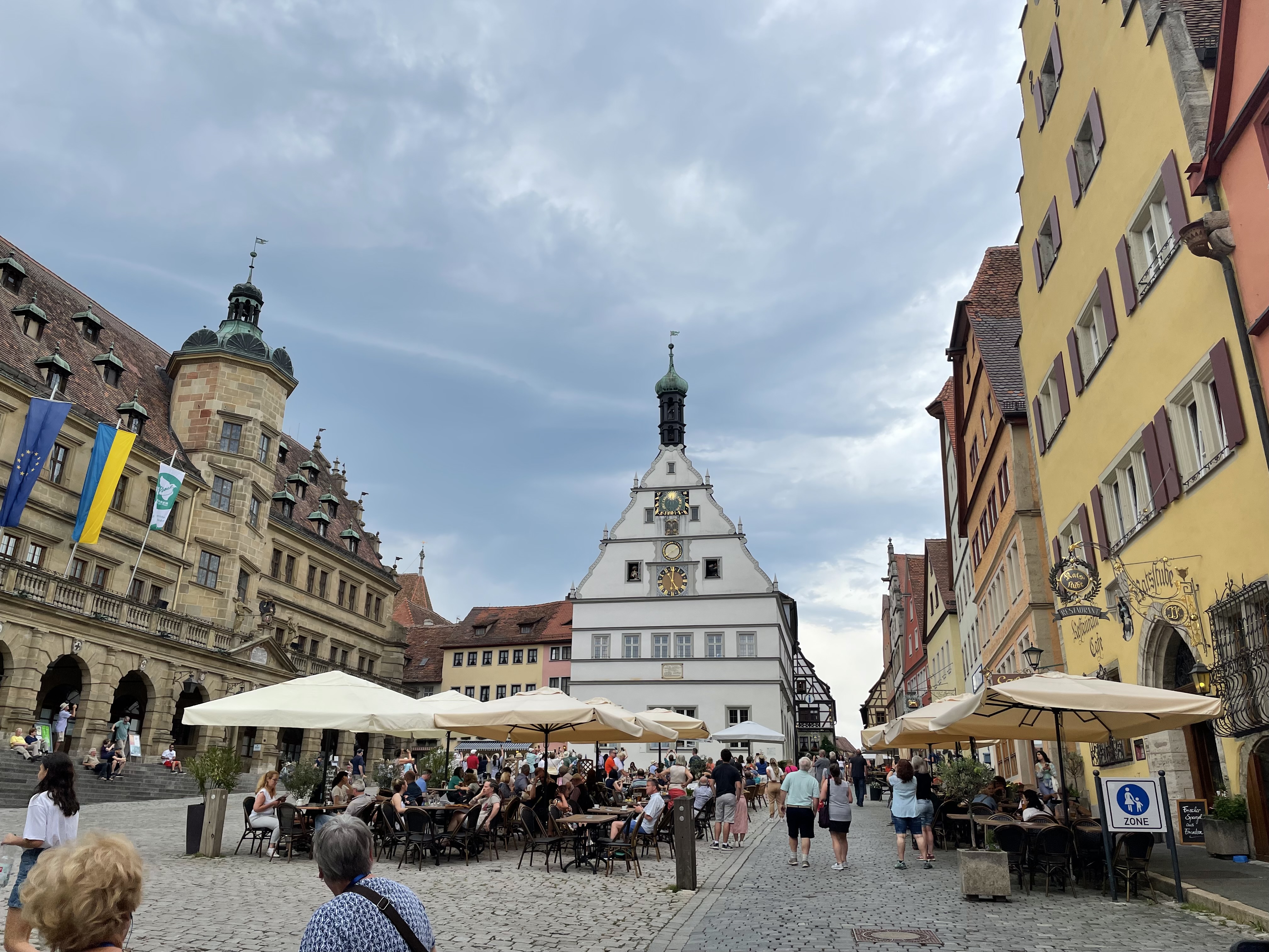
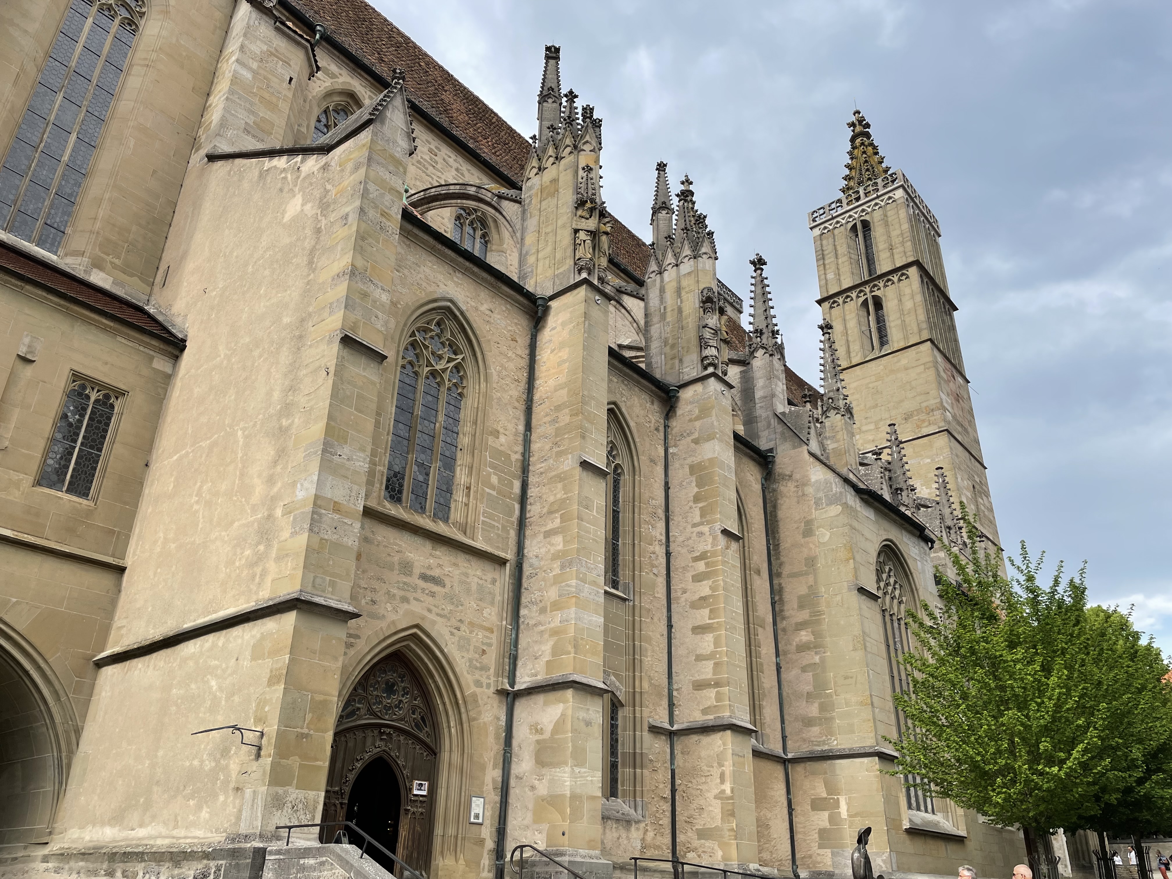
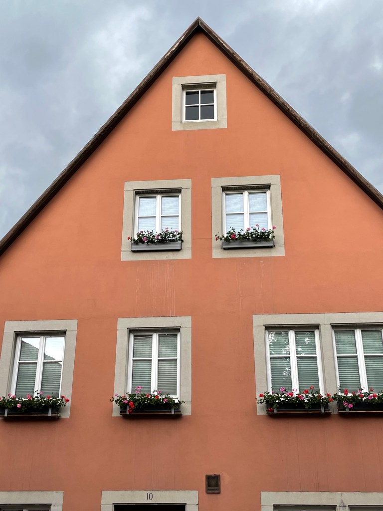
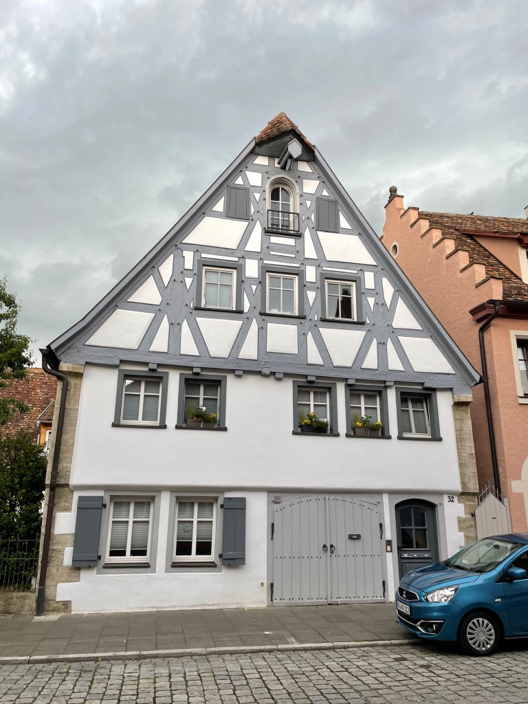
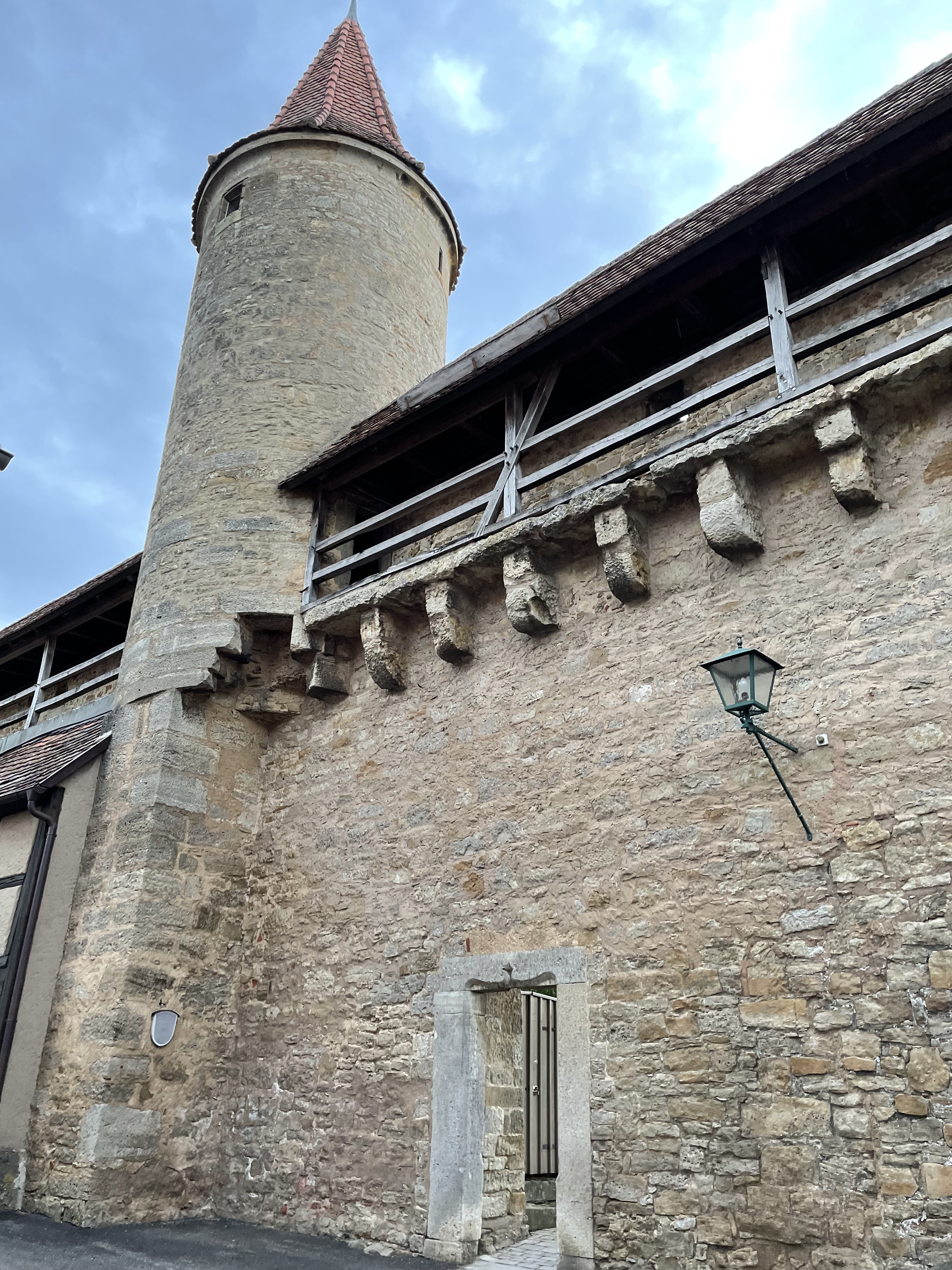
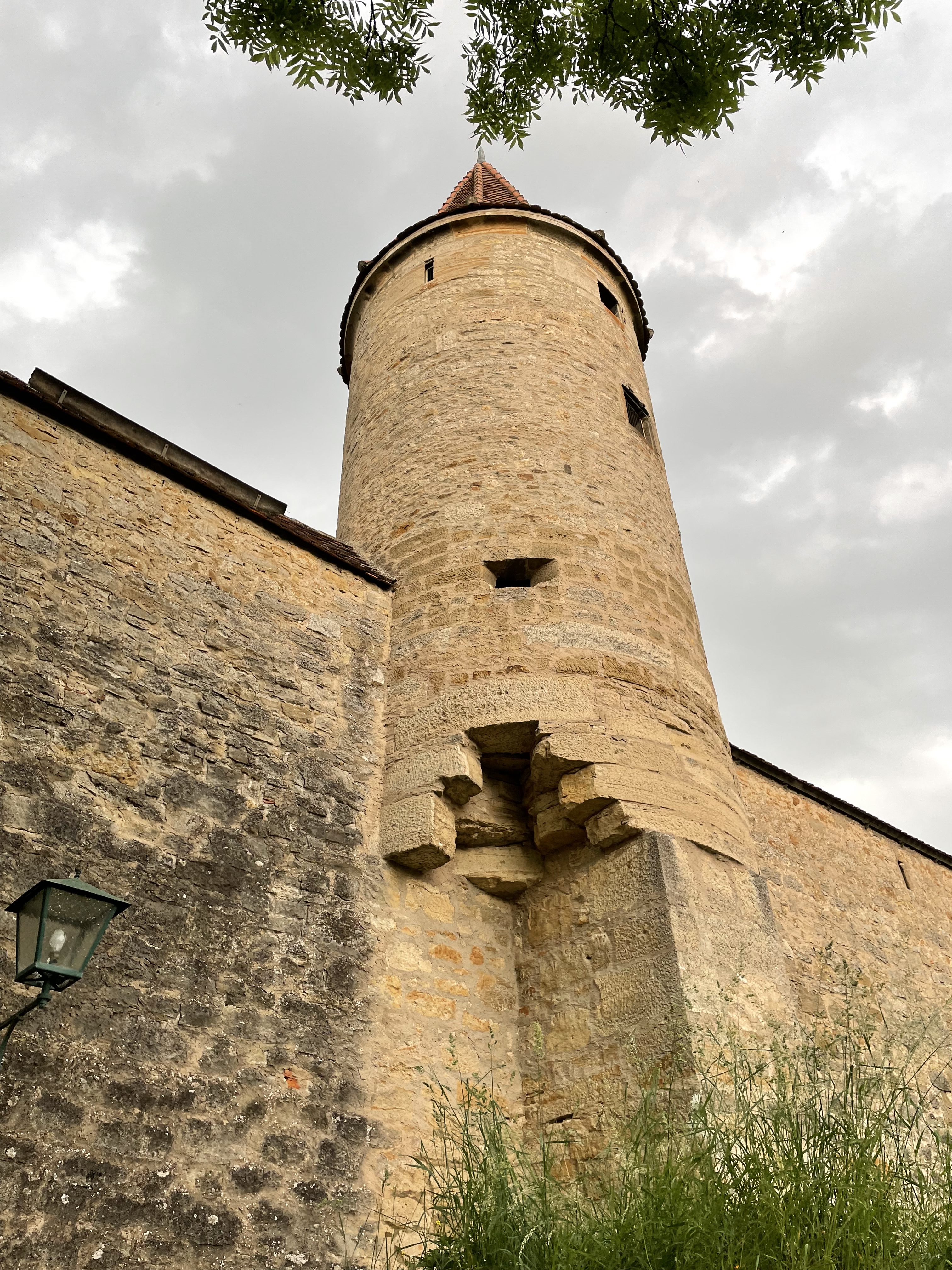
We finally arrived at our only tourist objective for the day, Rothenburg, Germany. Rothenburg is the best-preserved medieval town in Europe. The photos show why.
Unfortunately, we ran late since we didn’t leave Oberammergau on time. Consequently, we only had an hour or so to survey the town, and even then, a thunderstorm sent us hustling back to the bus. We didn’t do Rothenburg justice. I could have spent days exploring the old walled city.
From there, it was on to our hotel near the Frankfurt Airport, where we were to depart the following day. As we all know, the best laid plans don’t always work out.


You must be logged in to post a comment.