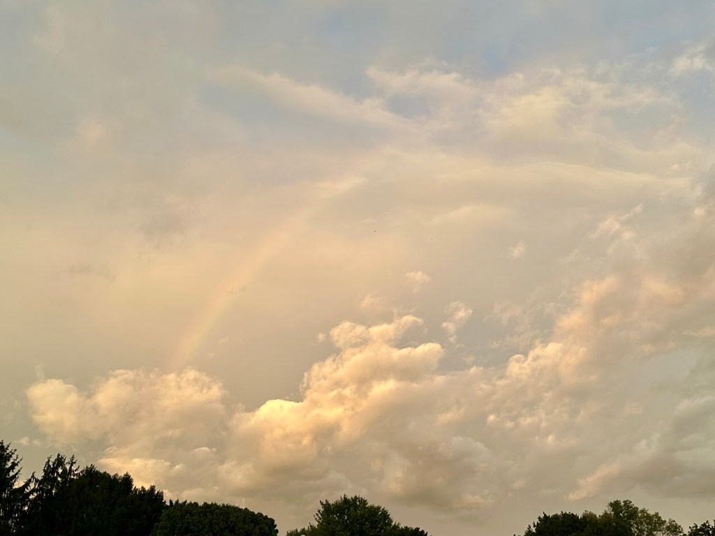
A faint rainbow at sunset. Photo by Bruce Stambaugh
The weather forecast didn’t call for it, but last night the westernmost edge of the significant nor’easter covered Virginia’s Shenandoah Valley just before sunset.
My wife and I were watching Major League Baseball when I noticed an eerie orangeish color in the northern sky. I rushed outside and spotted a faint rainbow in front of thick clouds in the eastern sky.
I grabbed my camera and headed to a farm with a clearer view to the west. The sun had already set behind the Allegheny Mountains, illuminating a few rogue clouds.
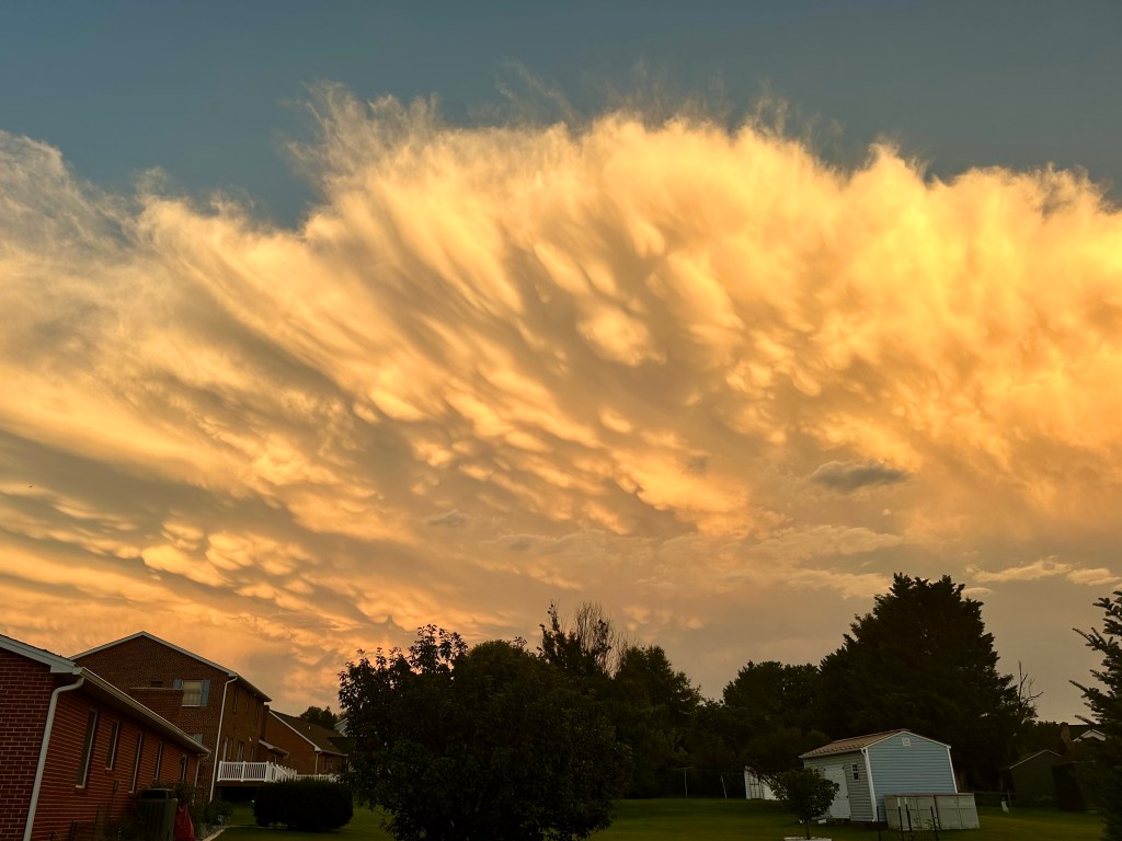
The backside of a severe thunderstorm. Photo by Bruce Stambaugh
After last evening’s storm passed, I stepped out the back door to check my rain gauge when this amazing scene stopped me in my tracks.
We had yet another storm, but it clearly had intensified as it approached the Blue Ridge Mountains and Shenandoah National Park, which serve as the eastern boundary of Rockingham County, Virginia, where we live.
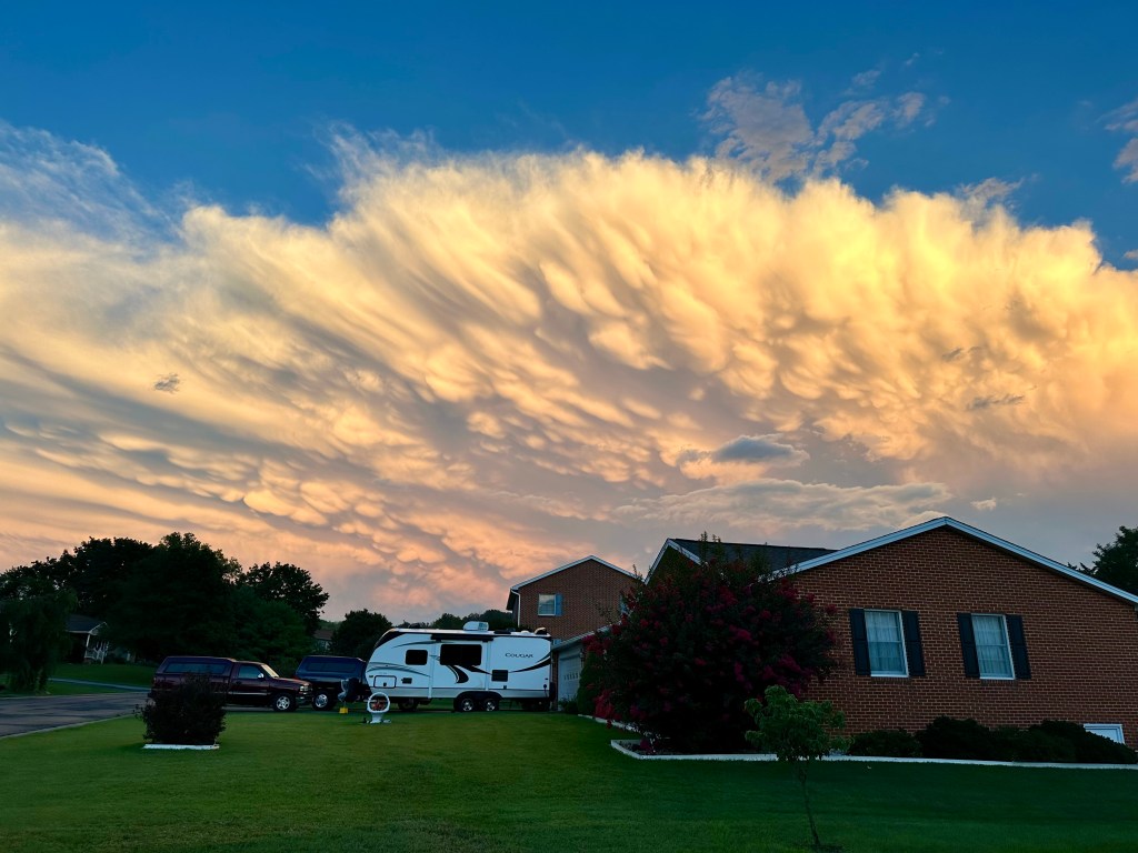
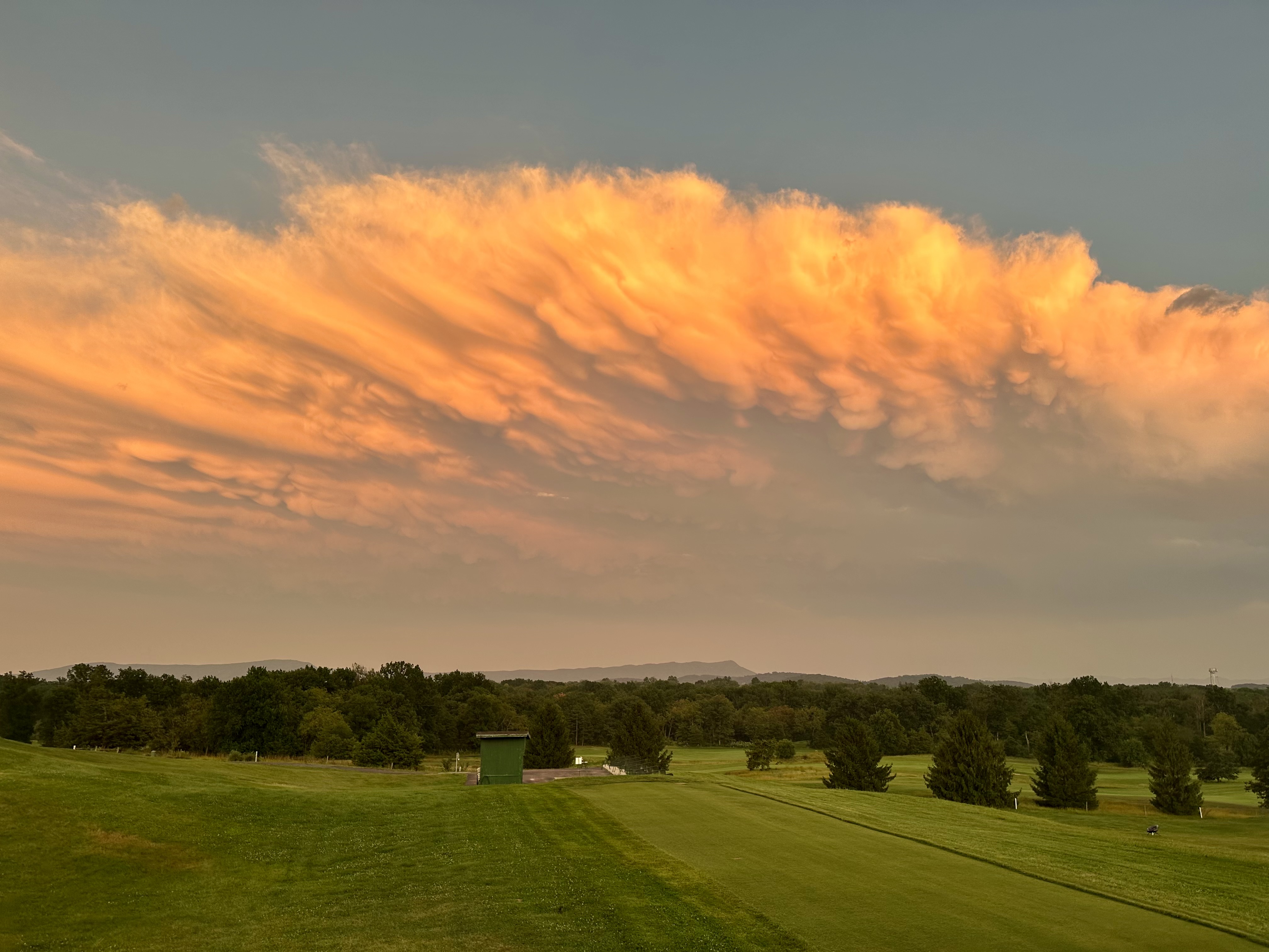
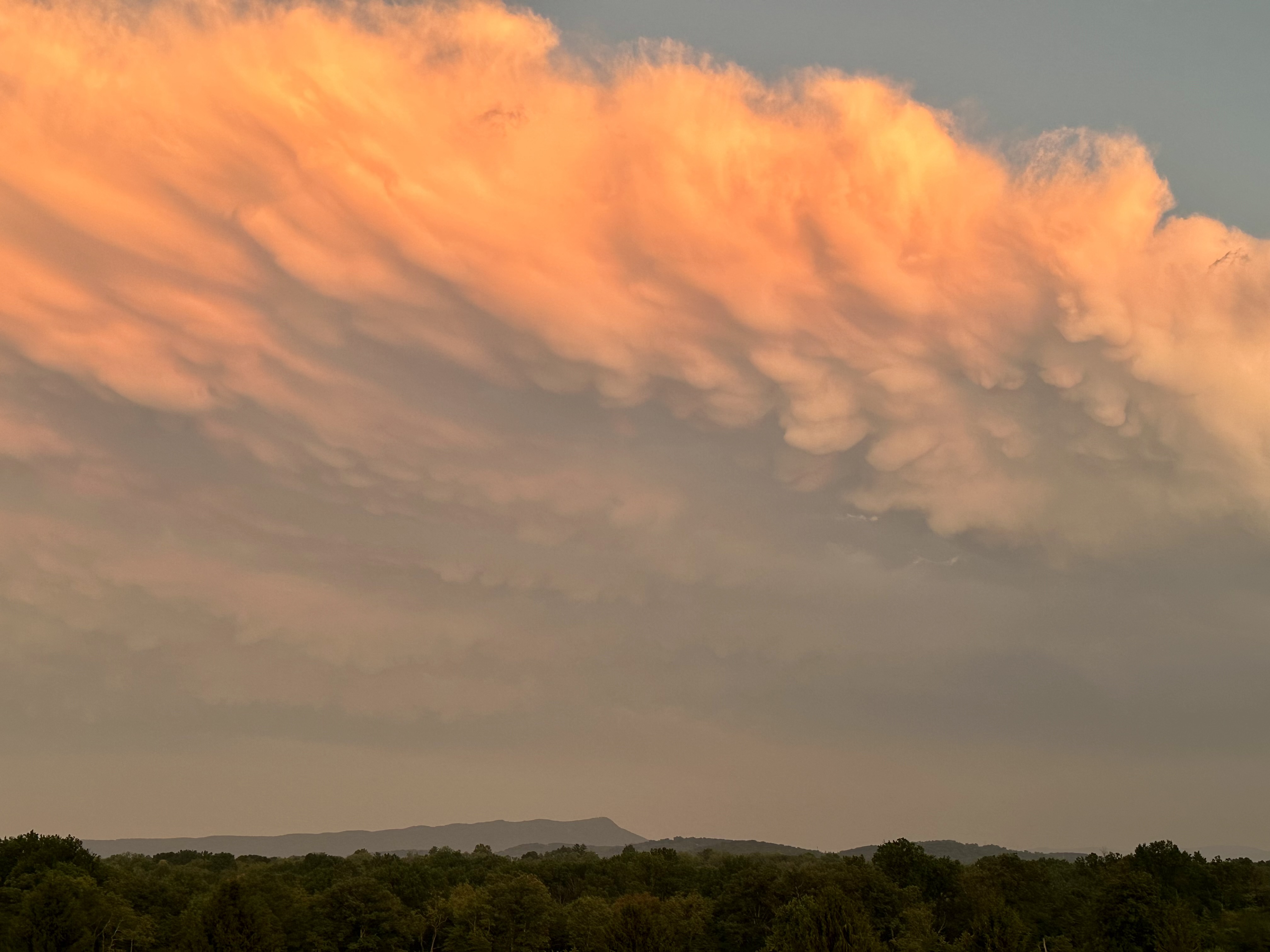
The view of the mammatus clouds from my driveway. Photo by Bruce Stambaugh
The setting sun dramatically illuminated the eastward-moving thunderstorm. The pouch-like clouds are mammatus clouds, formed when colder air aloft sinks into warmer air below.
Mammatus clouds almost always occur either at the lead of a severe thunderstorm or at the rear of the anvil-shaped thunderstorm crown. For meteorologists and those who appreciate and study clouds, spotting mammatus clouds is a rarity.
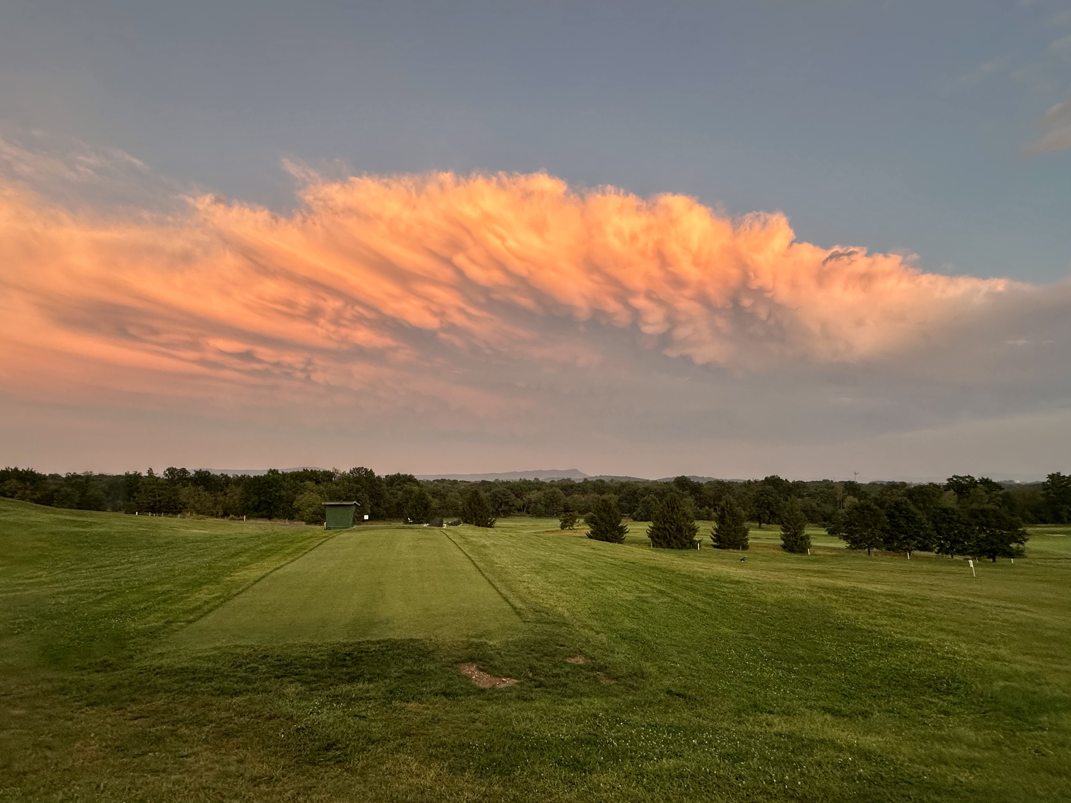
Since such clouds don’t last long, I wanted a view with a better line of sight. So, I headed to nearby Heritage Oaks Golf Course, behind an elementary school, which gave me an unobstructed view of the fast-moving storm.
As you can see, the turbulent clouds had already changed in the five minutes it took me to arrive at the golf course. Plus, the sun had set behind the Allegheny Mountains 30 miles to the west, changing the intensity and direction of its rays. Consequently, the colors of the clouds mellowed to more orange than white and yellow.
Please click on the photos to enlarge them.
Still, I was ecstatic to capture these shots, so much so that I never did check the rain gauge.
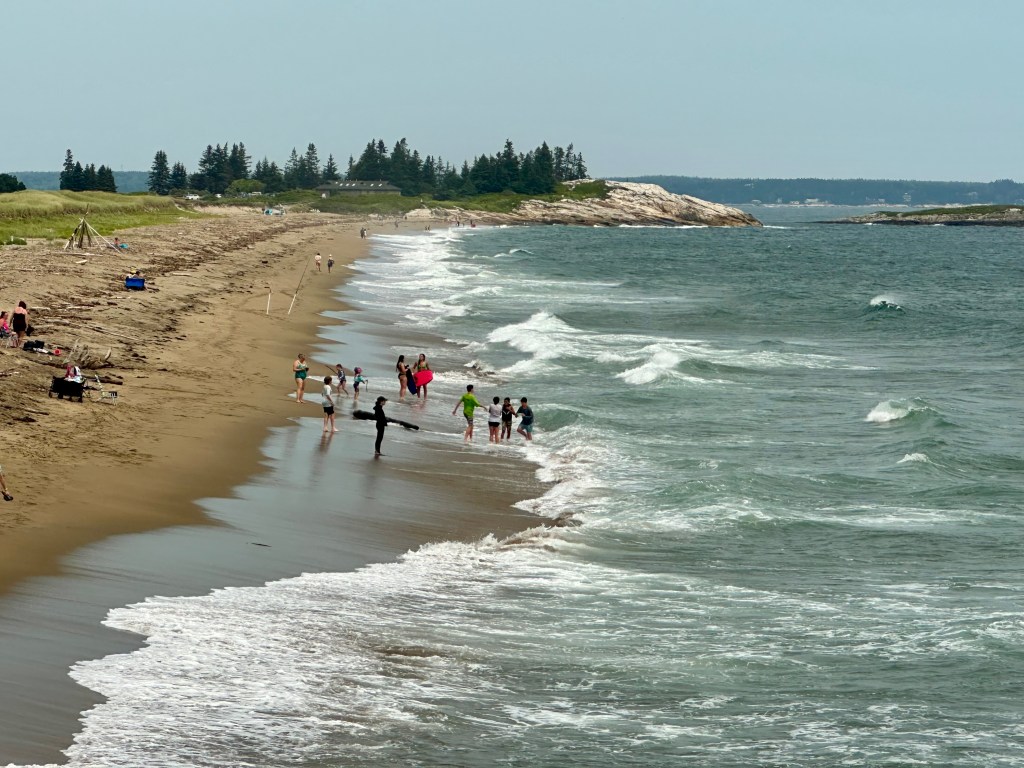
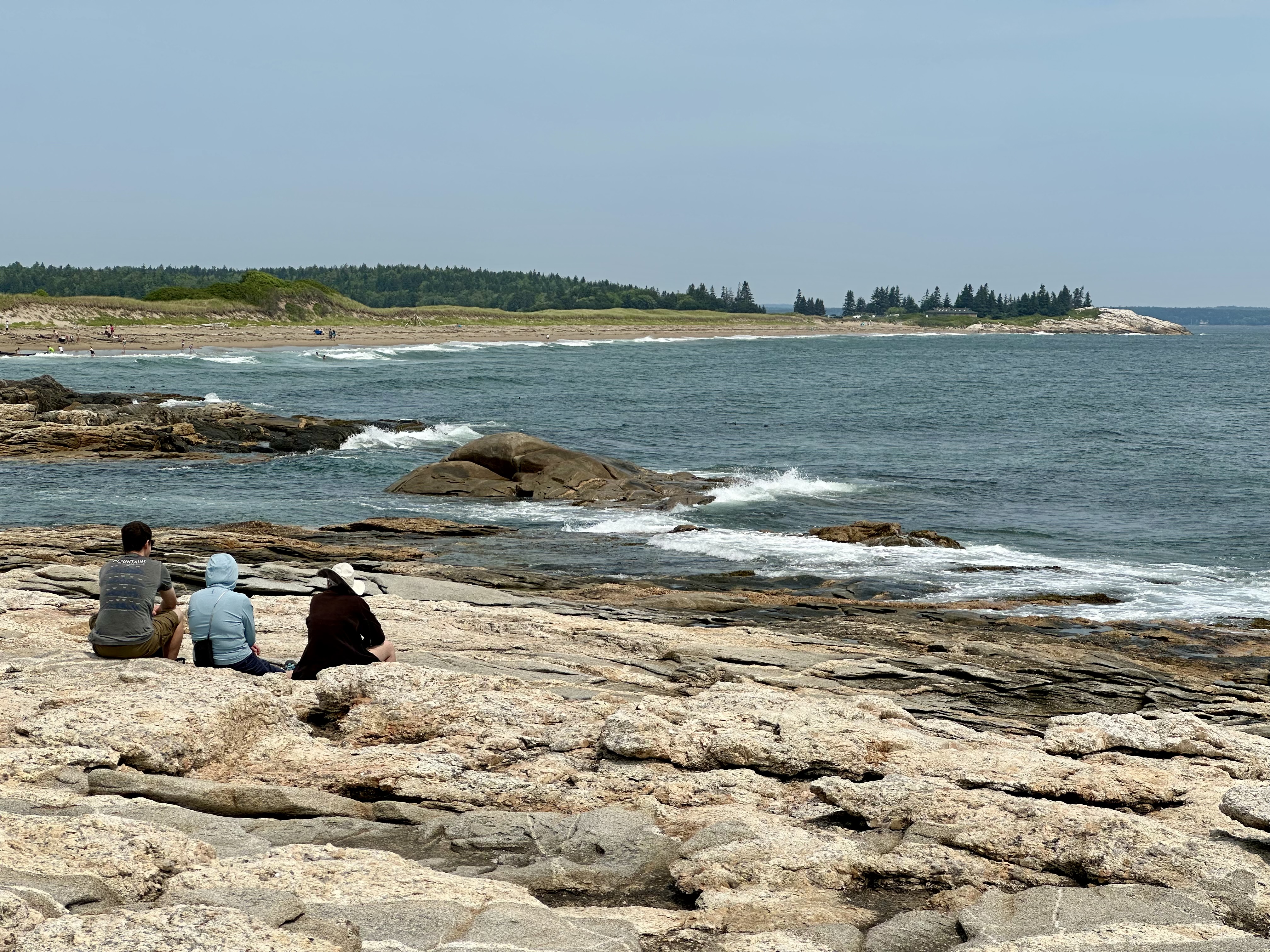
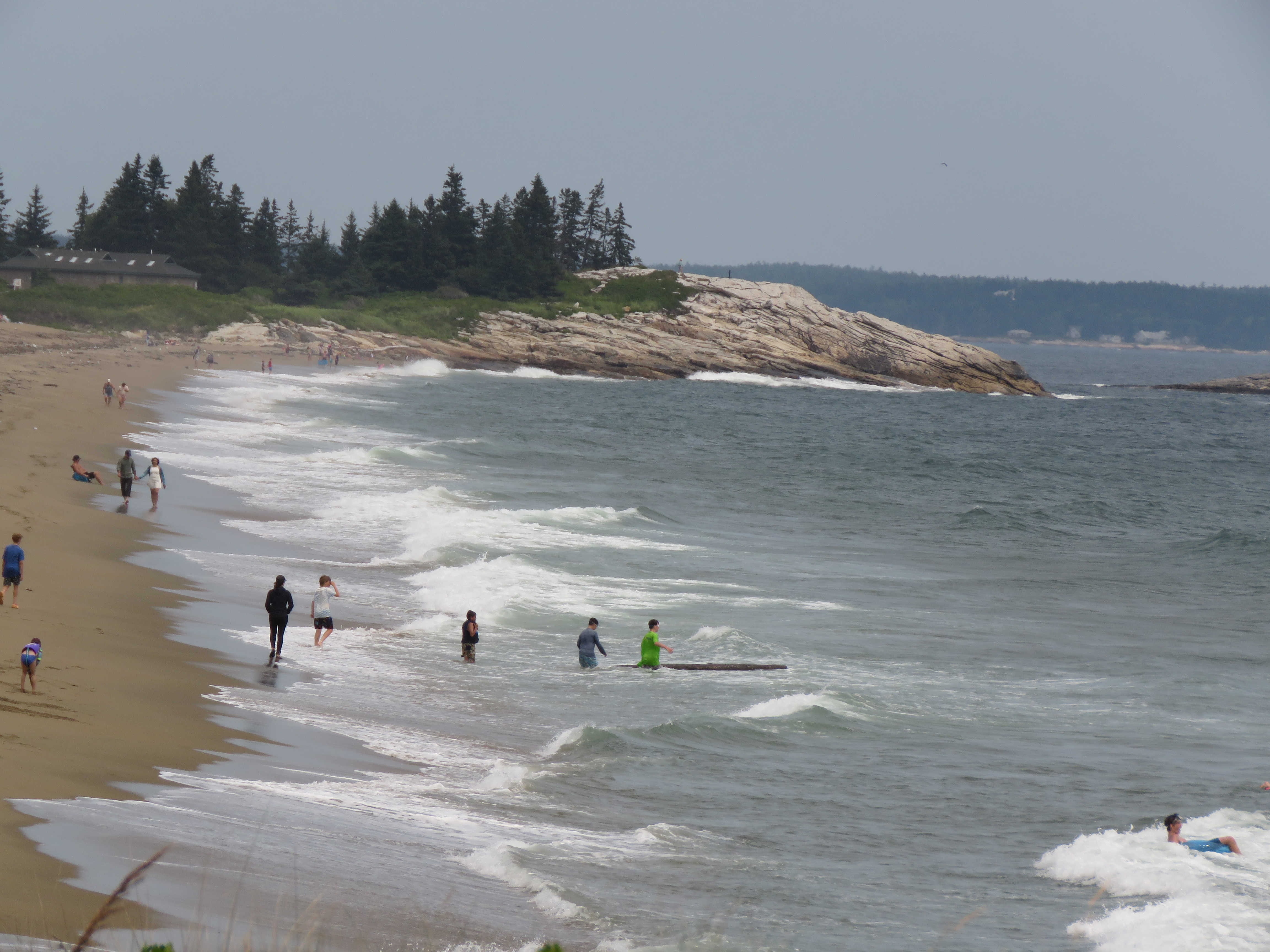
One of the beaches at Reid State Park, Georgetown, Maine. Photo by Bruce Stambaugh
Reid State Park lies a mile across the bay from the cottage where we stayed. To get there by car, we drove seven miles.
The park serves as an access to the ocean for the general public. It also stands as a stark reminder of Mainers’ desire to preserve and protect their precious and lovely coastline from too much commercial development.
Diana, our host, wanted us to experience the park the way other visitors do. It was also an opportunity for a wider perspective of the Atlantic Ocean than what we could see from her cottage in the woods across the way.
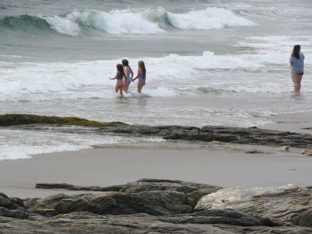
Young girls braved the waves. Photo by Bruce Stambaugh
With the tide high, the waves rolled in to the joy of the water lovers of all ages. Young girls braved the strong waves, trying to stay erect against the crashing force. Their mother stood on alert where the waves turned to foam.
Wanting to try to ride the larger waves ashore, teenagers snagged a driftwood log and walked it bravely into the breakers. I was afraid to watch further.
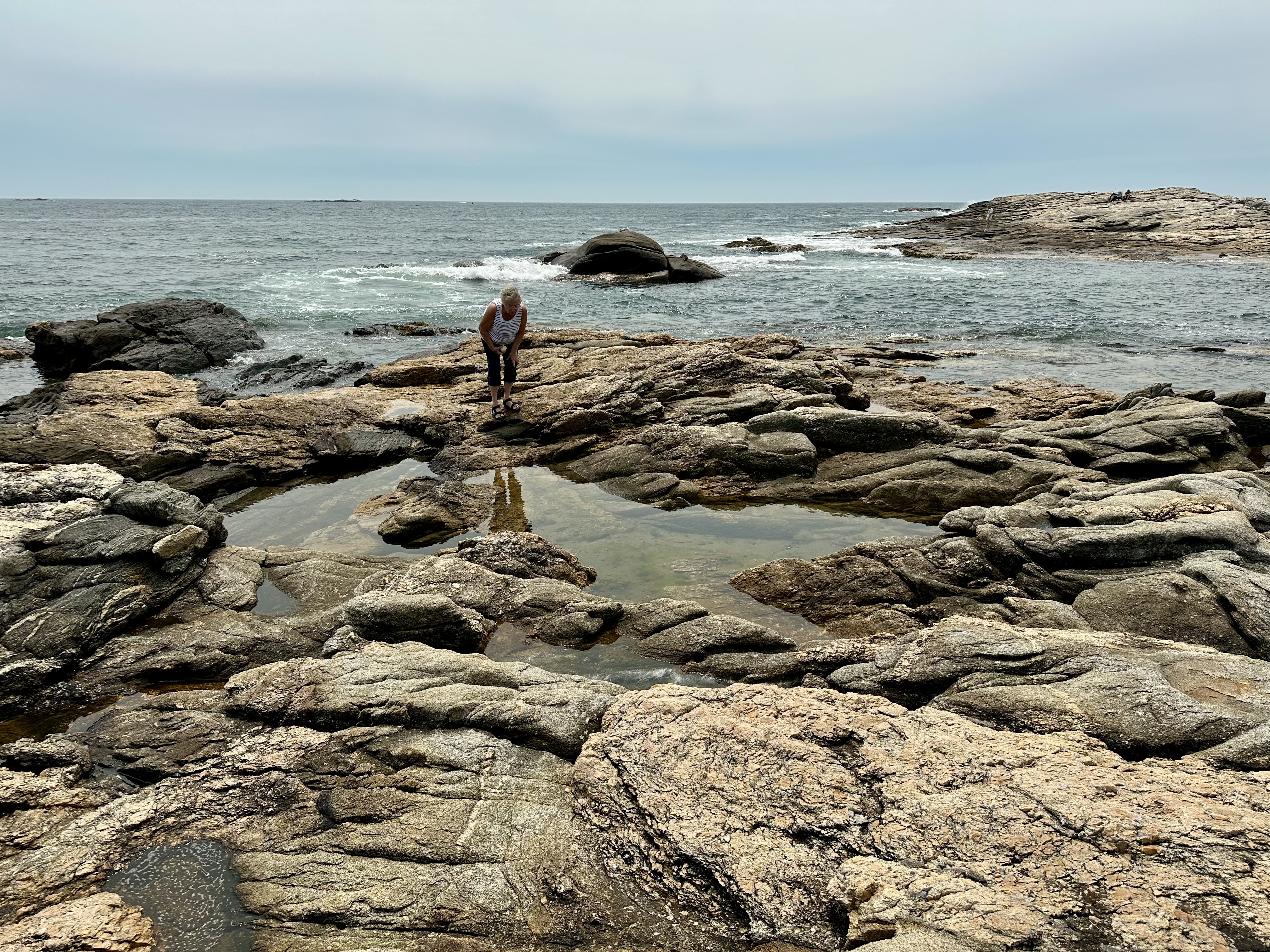
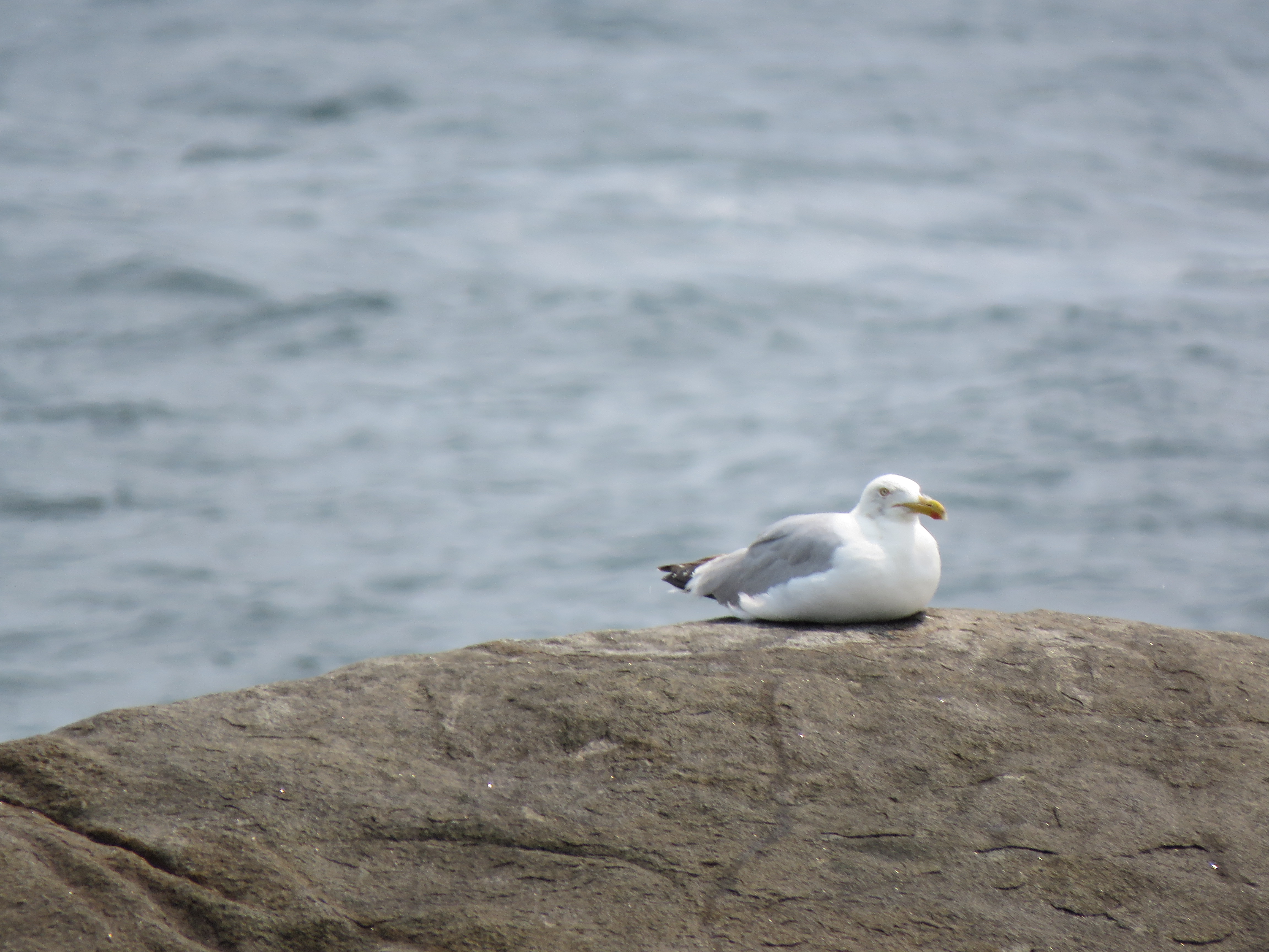
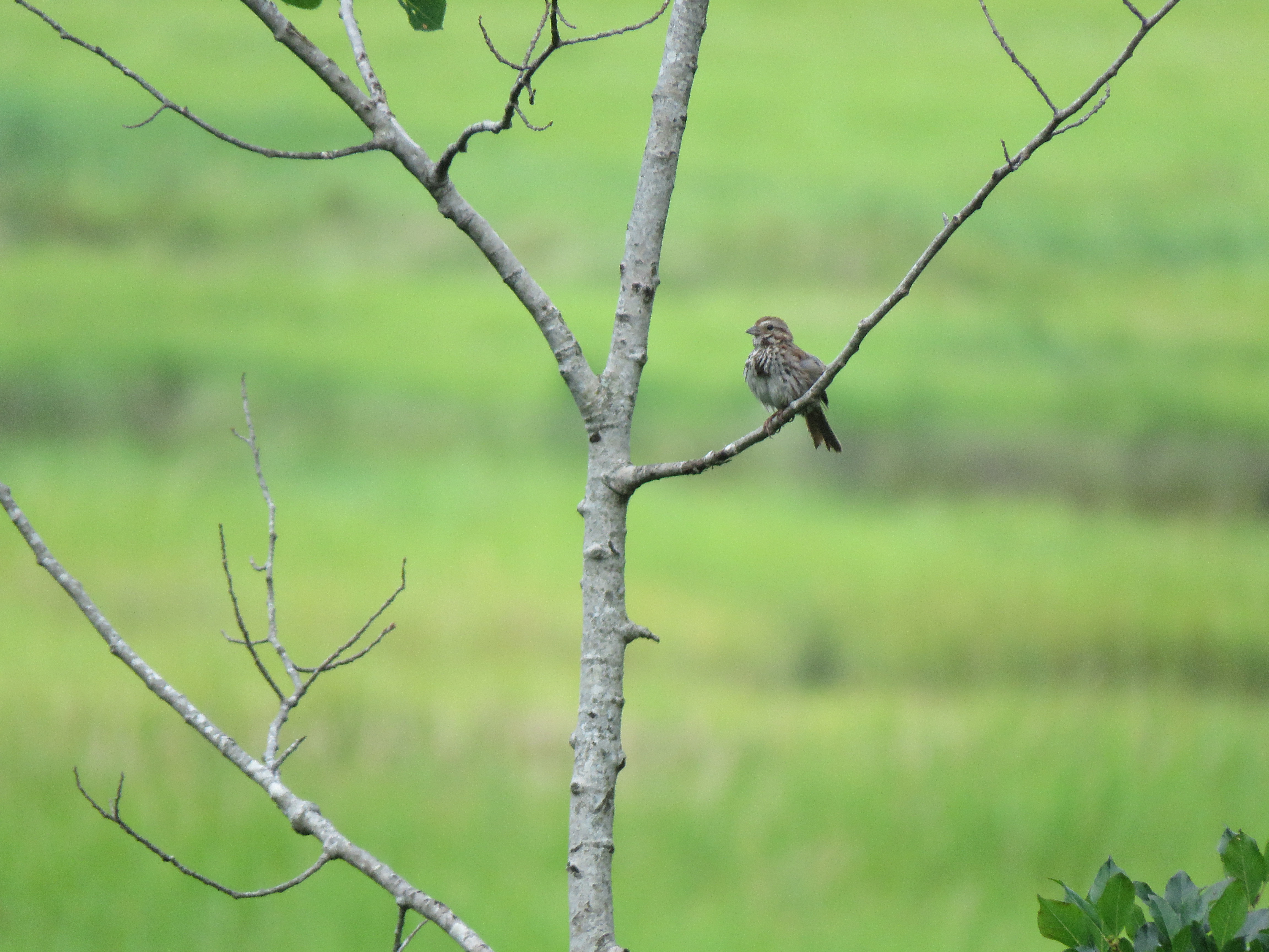
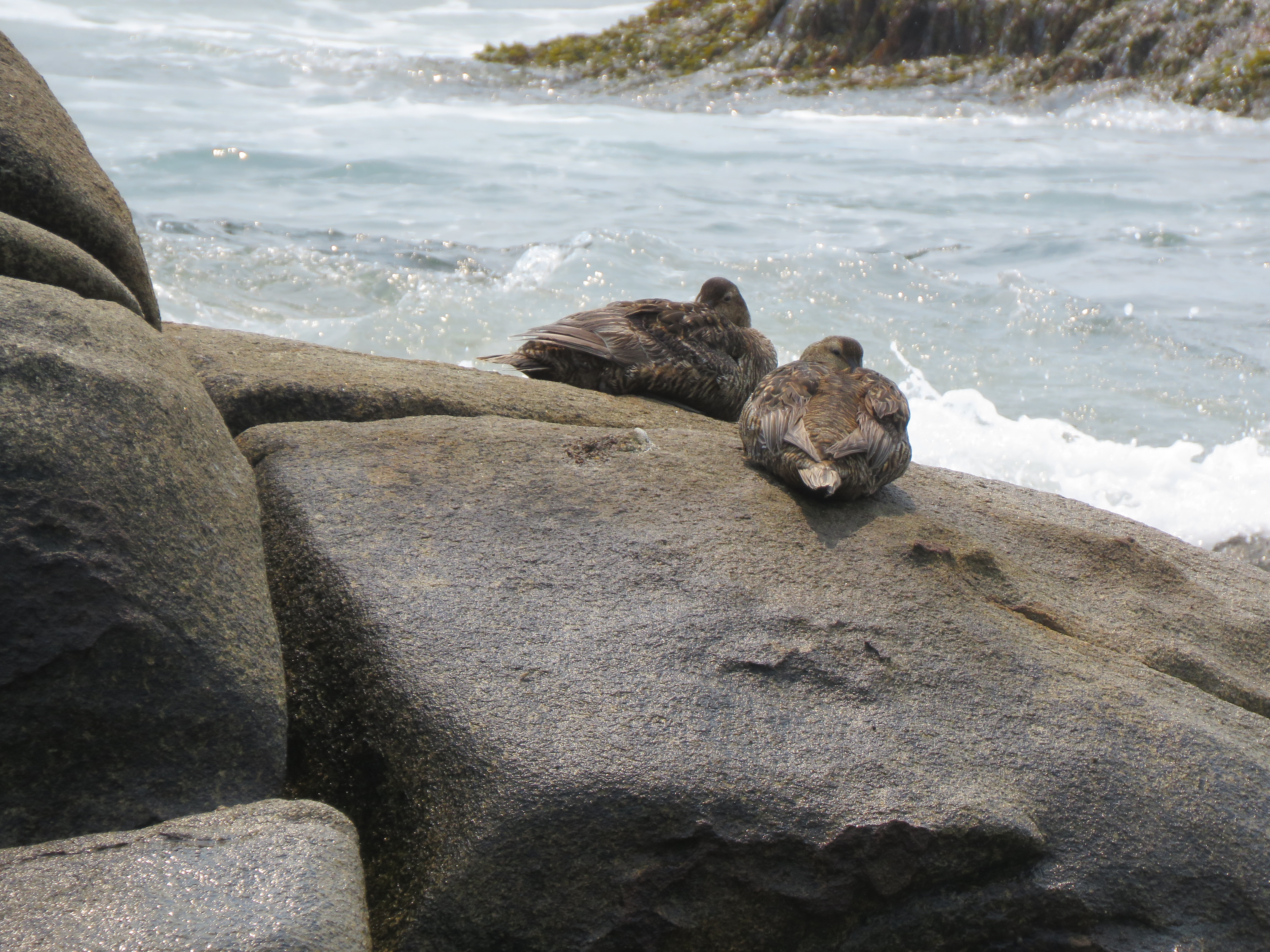
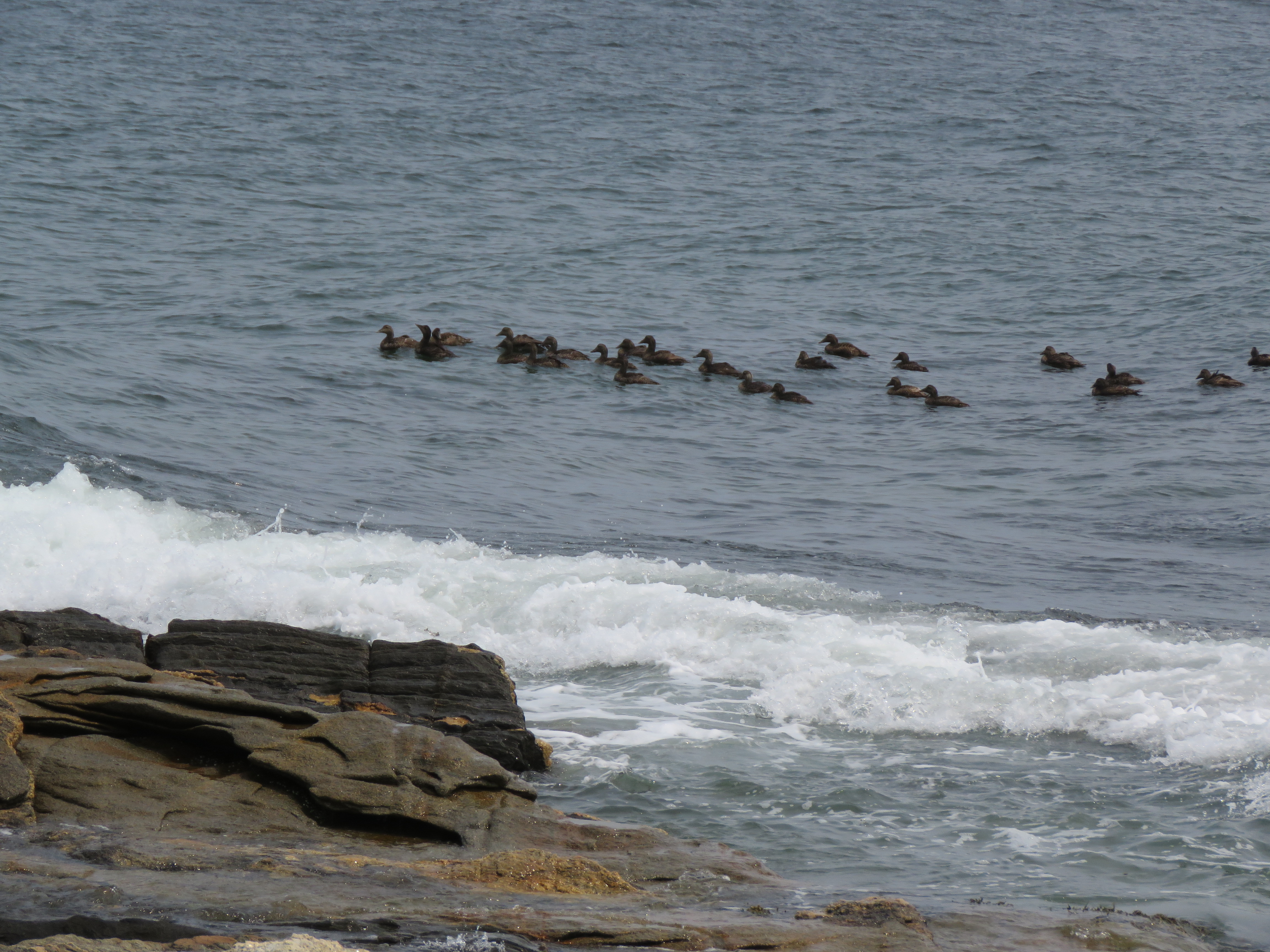
Ducks also rode the waves close to shore and out of the wind. Gulls perched on rocks or pestered picnickers for any discarded scraps. Song Sparrows darted from scrubs to sea oats in search of proper food. I stood on the giant metamorphic rocks for an elevated view of all the action.
People searched the tide pools in the rocks for any trapped fish and starfish. The park featured no water slides or swimming pools. The purpose was to enjoy all that nature offered, from water-worn boulders, sandy beaches, and birds and butterflies.
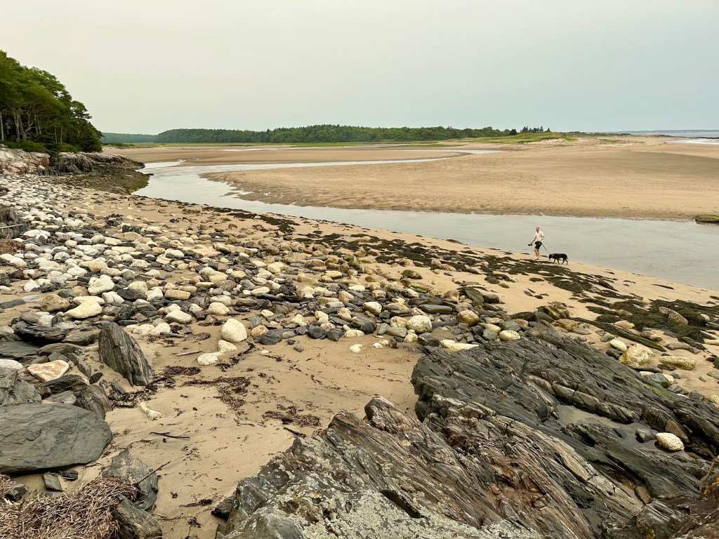
When we returned to the cottage, low tide revealed the tidal flats of sweep sand for all to enjoy in the park and beyond.
Low tide expands the park’s “beach” exponentially. Photo by Bruce Stambaugh
A cornfield with a view in rural Maine. Photo by Bruce Stambaugh
Somehow, we left New Hampshire for next-door Maine and ended up in Norway.
We left North Conway, New Hampshire, and the GPS took us on an unexpected route. We drove all country roads on the way to Maine’s capital, Augusta. We passed through one small town after another. Winding roads lined by deciduous and evergreen trees and occasional farm fields connected all the towns to one another.
We drove through Fryeburg, Lovell, Sweden, and Waterford. But we had to stop in Norway. Unlike the other burgs, welcoming storefronts lined Norway’s Main Street. It was lunchtime, so we decided to stop.
The quirky creativity of Norway, Maine.
When we exited our vehicle, music drew us eastward along Main Street. We looked for a restaurant as we went. We found the source of the music in no time. A lone musician played at the town’s weekly farmer’s market across the street.
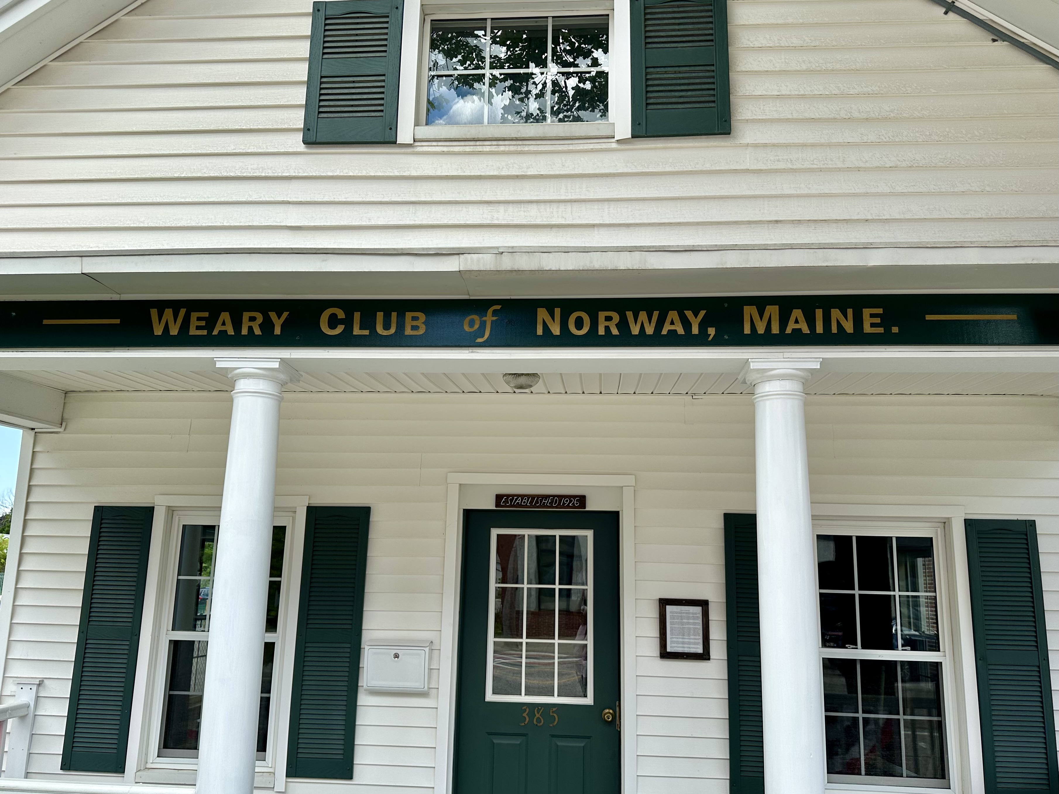
We checked it out and kept walking. The entrance to the local food coop stopped me in my tracks. Its eclectic entrance earned a photo. A few paces later, I stopped again to take a photo of the Weary Club of Norway Maine.
I had no idea what that was, and they weren’t meeting, so I looked it up. The “wearies” formed their social club 100 years ago. They were “the Shakers and Dealers in cedar shavings, social gossip, political wisdom, and Yankee philosophy.”
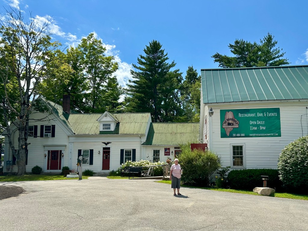
The Kennebec Cabin Company. Photo by Bruce Stambaugh
Not finding a place to eat, we kept moving over the rolling, tree-studded landscape and stopped in Manchester, Maine, at the Maine Cabin Masters gift shop and restaurant. Its official name is the Kennebec Cabin Company.
We ate outdoors in the shade to avoid the extreme heat. The house is the gift shop with the typical tourist offerings and prices.
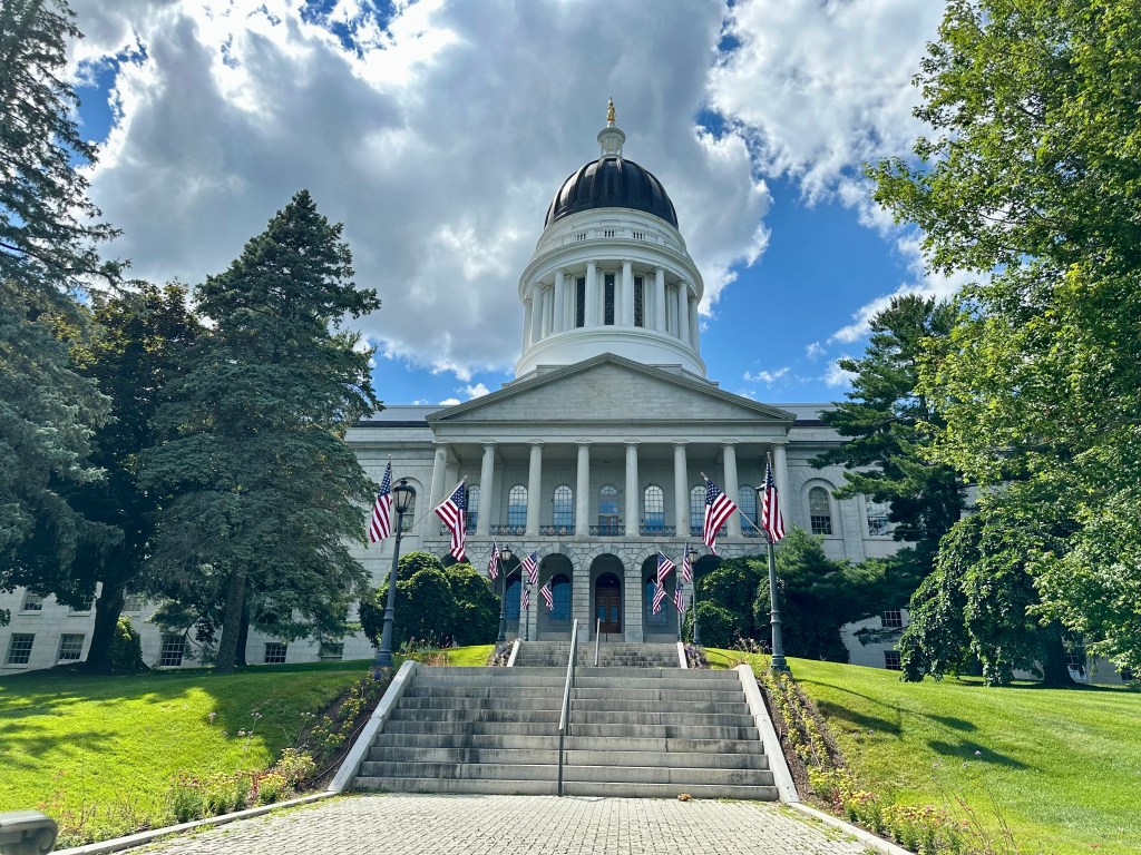
After lunch, we checked out the striking state capital building and drove to an adjacent town set on the bank of the Kennebec River for some ice cream. It was a refreshing way to end an intriguing day.
The Maine State Capitol Building. Photo by Bruce Stambaugh
This is how the famous mountain looked after we completed our round-trip excursion. From the left, the Mt. Washington Hotel, the cog railway, and the peak itself. Photo by Bruce Stambaugh
We left our friends’ home in Vermont’s Northeast Kingdom for an hour’s drive to the Cog Railway in Bretton Woods, New Hampshire. We arrived in plenty of time and discovered that we could take the 11 o’clock train instead of the noon one.
The other options for getting to the revered mountaintop are to drive up the private road, pay to ride up in a van, or walk up and back via the Appalachian Trail. My wife ruled out the first two, and our age and physical shape ruled out the other.
After receiving the rules for riding the railway, we boarded our car with the biodiesel engine at the rear to push us up the mountain. We followed two other such “trains” up the tracks.
The seats were slanting forward rather than at a 45-degree angle, which was uncomfortable at first. That soon changed as we chugged forward, and our seats felt comfortable as they adjusted to the mountain’s steep incline.
The fastest we clackety-clacked up the cog rails was five miles per hour. So, it took nearly an hour to get to the top.
When we left the station, we could see the mountain’s top with passing clouds. When we arrived atop Mt. Washington, we were in the clouds with only occasional views and a few hints of sunshine.
We had 50 minutes to eat lunch, which we took along, and to explore the historic mountaintop. Sudden bursts of sunshine interrupted my snack lunch. I rushed outside to capture whatever I could see. The view west was a wall of gray.
Please click on the photos to enlarge them.
I could see east and north, however. I saw the Appalachian Trail, which winds up and down the mountain. Cairns marked its path instead of white blazes on trees. A few hikers trekked amid the cloudy mist.
Having been to that area seven years ago, I could identify the Wildcat Ski area and the scenic New Hampshire Route 16 that runs from Gorham south through Pinkham Notch and down the valley to Conway.
So, the $100-a-piece ride wasn’t a complete bust. However, in the hour it took to return to the base station, the sky had cleared. Mt. Washington stood as handsome as ever above all the other presidential peaks.
Proof we made it to the top. Photo by Bruce Stambaugh
The iconic view of Stowe, VT, without the fall colors. Photo by Bruce Stambaugh
Before visiting friends in Vermont’s Northeast Kingdom, my wife and I enjoyed the eye-pleasing scenery of the Green Mountain State.
After a stop at Cabot’s Cheese, we visited Stowe, Vermont’s tourist magnet. Despite the excessive heat, we weren’t disappointed. The young lady at the visitor center helped us make the most of our limited time there.
The Little River flows behind the Stowe Community Church. Photo by Bruce Stambaugh
We walked through part of the town to photograph the iconic church with its towering steeple and to find the recommended restaurant for a refreshing salad and hydration. We found both.
After lunch, we took the Stowe Hollow self-guiding tour and found some incredible scenes even in summer. I can only imagine these vistas decked out in fall’s brilliant, warm colors.
Even with fifty shades of green all around, we found the countryside surrounding Stowe stunning. From unique barns and homes with views to covered bridges and the Green Mountains as the backdrop, we left Stowe amazed but ready to fellowship with our friends.
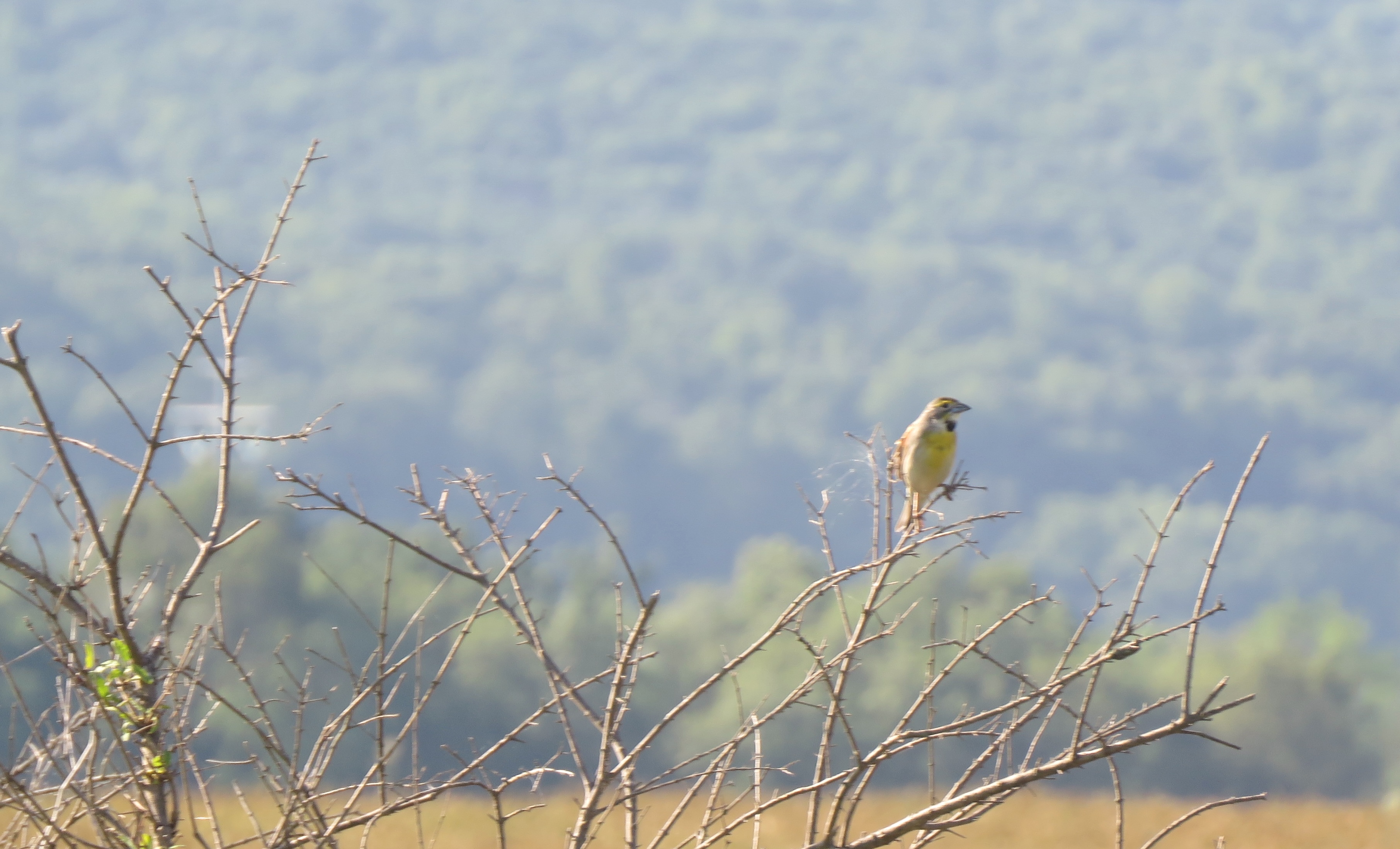
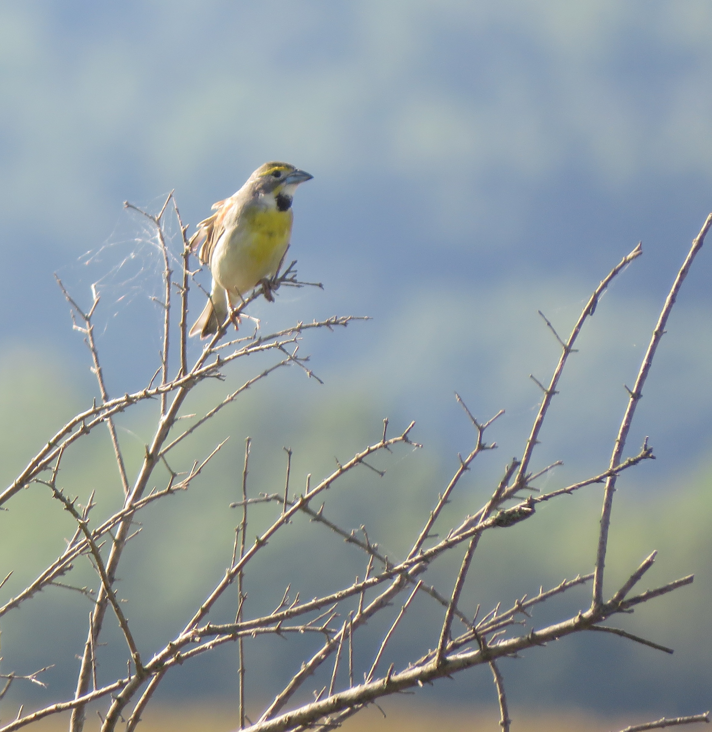
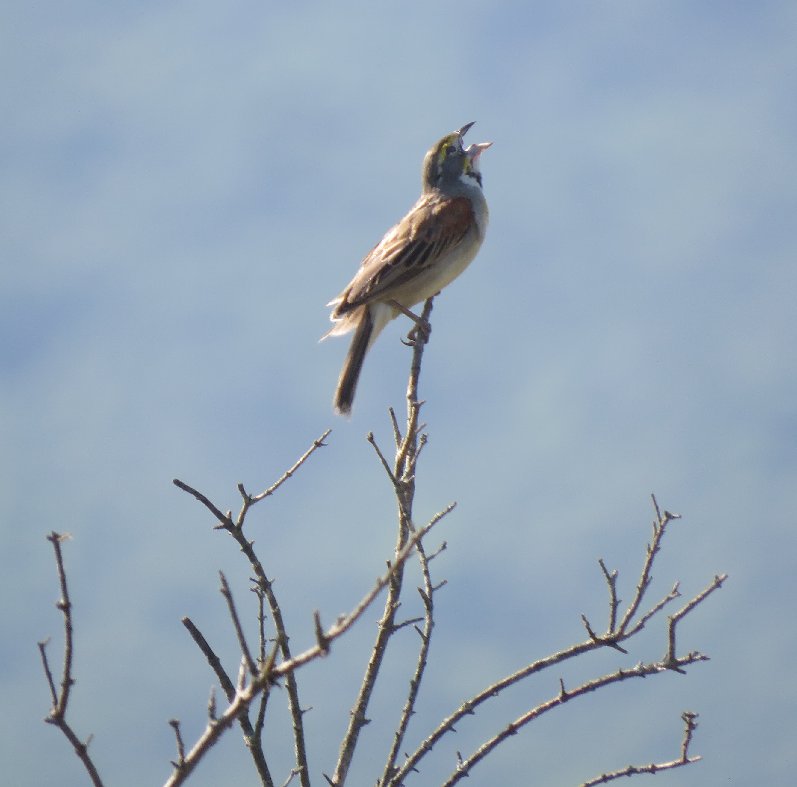
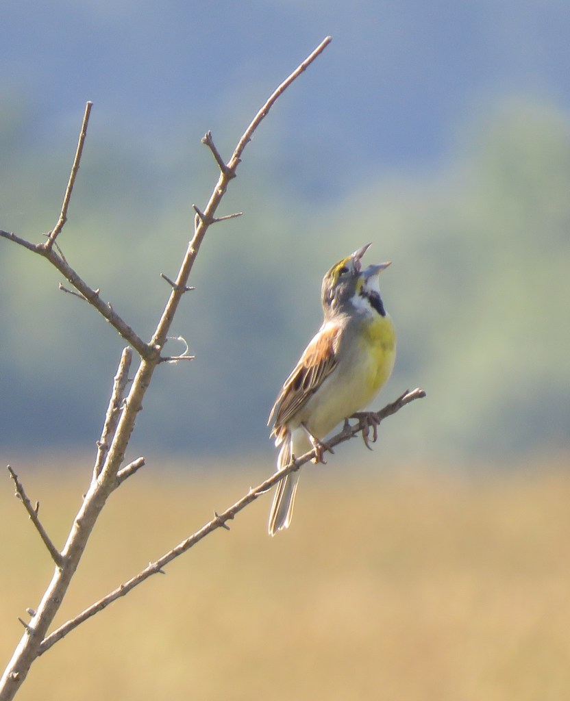
A birding friend of mine messaged me that he had found a Dickcissel singing on a fence post along Moores Mill Road, 20 miles from my home. I had to wait a day to chase the rarity in Virginia’s Shenandoah Valley.
Colored like a miniature Eastern Meadowlark, the chunky grassland bunting occasionally wanders east from its mid-American breeding habitat. I had seen Dickcissels before when we lived in Ohio, but this would be my first in Virginia.
The narrow country road cut through two farm fields, with wire fencing hugging both sides, making it easy to spot the wayward bird. I made sure I left early in the day to see this bird. As it turned out, there was more than one.
To get there, I drove most of the way on the Valley Pike, also known as US 11. The historic roadway was the main route up and down the storied valley until the interstate opened in the 1960s.
Both Confederate and Union troops moved up and down this highway and on May 15, 1864, fought a battle in New Market, only a few miles north of where the Dickcissels were. It was easy to envision soldiers marching along and cavalry horses kicking up dust on what was then a dirt road.
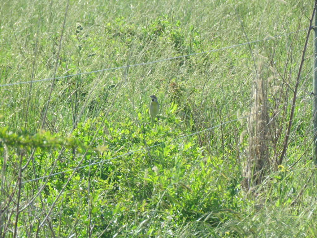
A Dickcissel on a fence wire. Photo by Bruce Stambaugh
I turned east on Moores Mill Road, stopped a quarter mile off of US 11, stepped out of the car, and listened and looked for the short, buzzy song. AllAboutBirds.org describes the grassland bird’s song as “fairly short but hard to miss, a clicky buzzing dick-dick-ceessa-ceessa.” Thus the bird’s name.
Soon, I heard the bird, and then another calling on the opposite side of the road. One bird perched on a tall weed in a grassy field to the south. A Dickcissel on the north side sang a fence wire. I wasn’t sure which way to look.
I snapped a few photos before a car approached from the west and slowed. The birding vest I wore, the binoculars around my neck, and the camera in my hand were a dead giveaway to the driver about what I was doing.
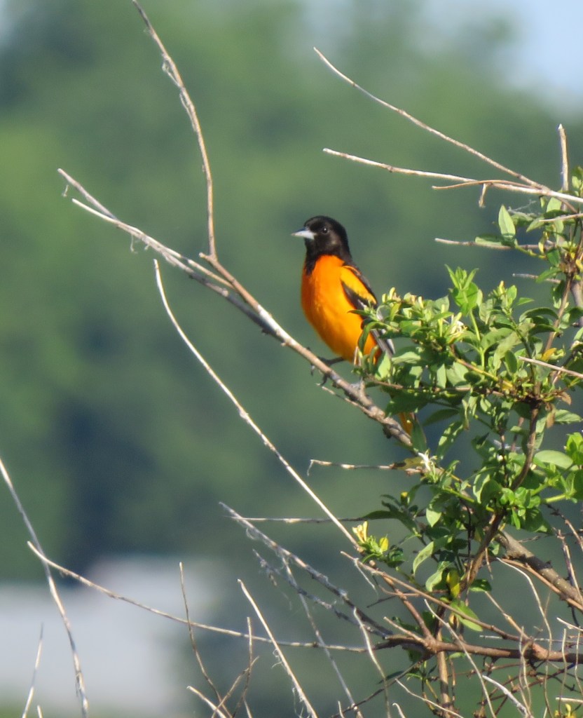
The Baltimore Oriole. Photo by Bruce Stambaugh
At first, I thought the vehicle would pass on by. Instead, it stopped. I had just snapped a photo of a Baltimore Oriole, which didn’t spook as the car passed by.
The driver stopped to see what I was up to. He was a man in his 70s, gaunt, and unshaven. With the driver’s-side window down to talk, I noted piles of clothes, used fast-food cups and wrappers, and other items filled his 10-year-old vehicle. Rather than judge, however, I asked if he lived nearby.
“No,” he said, “I live a few miles west of here. I’m on my way to get breakfast at one of the restaurants in New Market.”
In my head, I questioned why he was driving east when New Market was straight north. Still, the man wanted to know what kind of birds I was seeing.
All the while, one of the Dickcissels had perched on a bare, thorny bush 50 feet in front of the car, and the oriole still sang from a tall, leafy bush 50 feet behind.
Not surprisingly, the man had never heard of a Dickcissel, but he perked up when I told him I had seen and heard a Baltimore Oriole.
“Man,” the guy exclaimed, “I haven’t seen one of those birds around here in a long time.”
Rather than pointing out the oriole singing in the bush behind him, I showed him a photo of the bird on the camera’s rear screen. He couldn’t believe it.
I asked him if he knew where the road got its name, and he immediately replied. “Well, a long time ago, a man named Moore owned the land on both sides of the road,” he said. “He had a grist mill on the creek about a quarter of a mile south of the bridge.” He pointed east toward the stream.
I thanked him for the information and, wanting to get back to birding, told him I didn’t want to keep him from his breakfast. He told me he appreciated my showing him the photo of the oriole and continued on his way.
I was intrigued by the man and wondered if he was actually homeless, given the interior of his vehicle. The 15 minutes I spent chatting with him hadn’t really been an interruption at all. I spotted birds even as he talked.
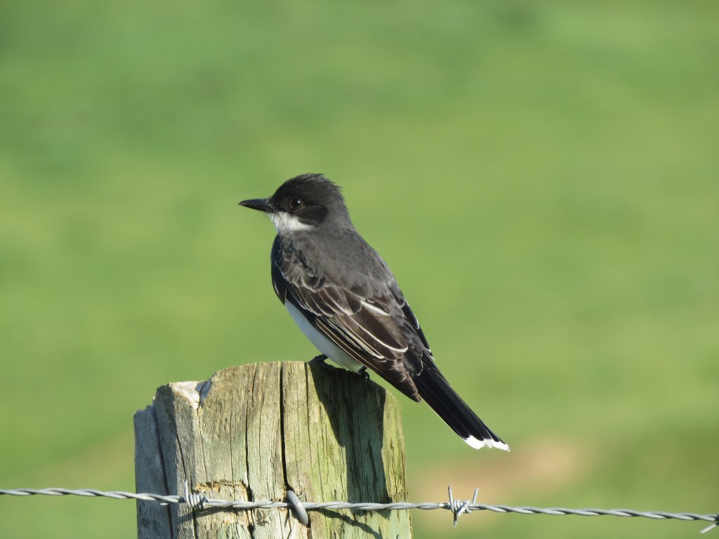
Eastern Kingbird. Photo by Bruce Stambaugh
I continued birding and recorded several species typically found in this grassy habitat. An Eastern Kingbird gave me good looks right from my car. A Savannah Sparrow sang somewhere from the tall grasses. A Gray Catbird practiced its imitations of other birds before dashing for cover.
Curious, I drove east as the road descended to cross the creek. The man was right. The leaves on the sycamore trees growing along both sides of the creek banks obscured my view of the old mill’s remnants.
I turned around to head home when another car approached. Another birder wanted to add the Dickcissel to her yearly list. She already had photos of the birds by the time I stopped to share where I had seen them.
The Dickcissels could have simply been migrating. I’ll return to Moores Mill Road to see for myself. When I do, I’ll be surprised if that day can match the serenity of this morning.
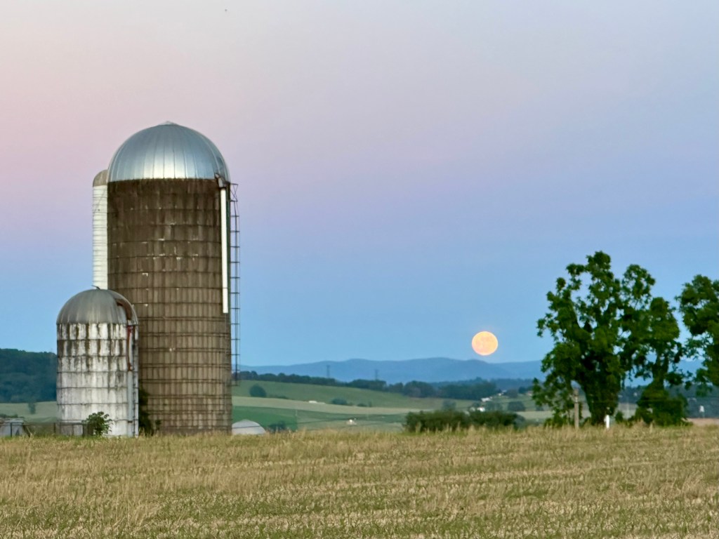
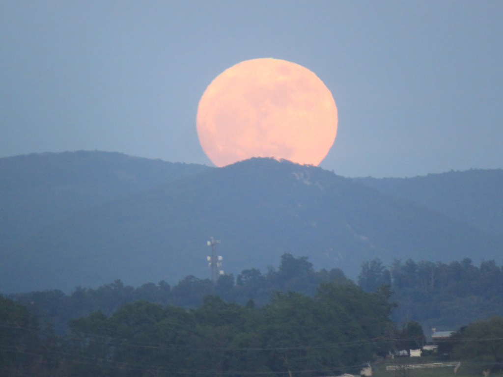
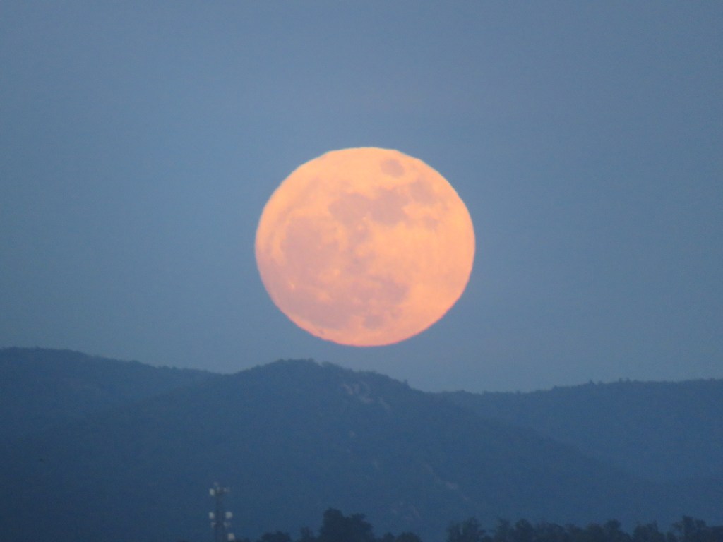
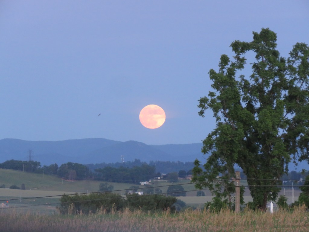
The Blue Moon rose above the Blue Ridge Mountains on May 30, 2026. Photo by Bruce Stambaugh
The only Blue Moon of 2026 was set to rise near Harrisonburg, Virginia, at about 8:30 p.m. Saturday, May 30. Officially, it wouldn’t be 100 percent full until 3:45 a.m. Sunday morning.
So, I chose to try to shoot the moon, so to speak, Saturday evening. I wasn’t getting up at 3 in the morning to take a photo of the full moon. I have a hard enough time sleeping as it is. You’ll understand when you hit 78.
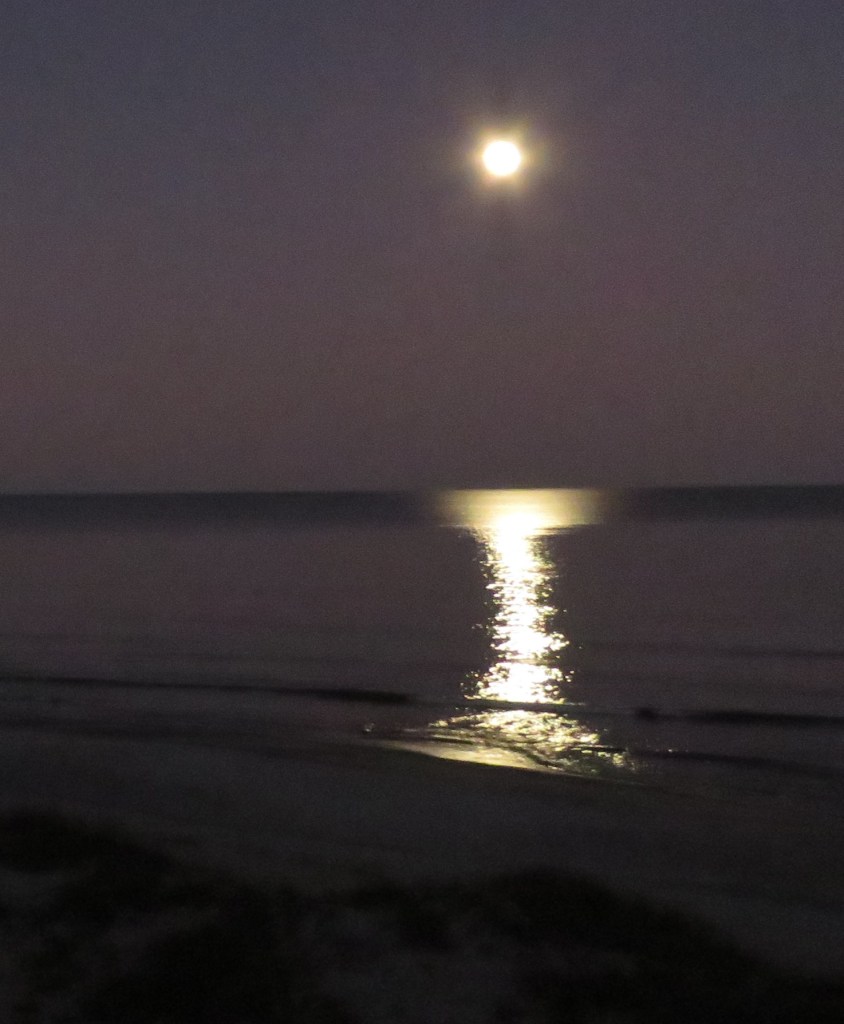
Old as I am, I still thrill at the sight of a full moon peeking over the horizon, whether it’s on the land or at sea. Perhaps the only difference is that a moon rising over the ocean casts a spectacular reflection if the water is calm.
A January full moon rising over the Atlantic Ocean left an hourglass reflection. Photo by Bruce Stambaugh
Since we moved to Virginia’s picturesque Shenandoah Valley from Ohio nine years ago, I’ve learned that the moon evokes just as much magic as it sneaks over the Blue Ridge Mountains, which, in our area, is also Shenandoah National Park.
I checked a website that shows the time and direction of moonrise for any given area. It showed the moon rising in the southeast sky, which made sense as I thought about it. The sun and moon work in tandem. So, with the sun now setting in the northwest, the full moon would rise directly opposite at the same time.
That meant I needed to find a spot with a clear view to the southeast. With all the hills in the valley, that wouldn’t be too hard. However, I also had to account for power lines and cell phone towers. In Virginia, that’s easier said than done.
Unfortunately, I underestimated how far southeast the moon would rise. So, when I spotted its first glow over the park, I needed to drive to a better spot. Even then, I wasn’t clear of the infernal towers and strings of lines.
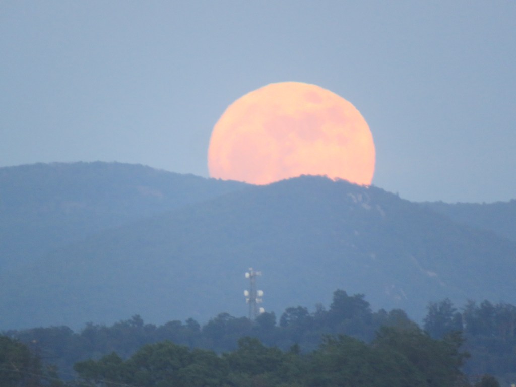
Nevertheless, I still managed to capture a few frames of the smallest full moon of the year rising above the bucolic valley. Not only was this full moon the only blue moon of the year, but it was also the farthest from the sun, which is appropriately called a micromoon.
As the moon edges over the horizon, whether at sea or on land, it appears bigger than when it is high in the night sky. That is merely an illusion; ironically, science has yet to explain why it occurs.
Dusk is not exactly the best time to photograph objects, especially moving ones. Still, I snap away and enjoy sharing the results with others.
Earth Day is our annual reminder of humankind’s responsibility to care for our precious planet, our earthly home.
Activities of all kinds are planned worldwide to educate and engage the public on the importance of intentional conservation. We use the Earth’s resources, but we must be mindful not to abuse our sacred soil, forests, waterways, atmosphere, and wildlife.
May we all do our best each and every day to care for our Mother Earth.
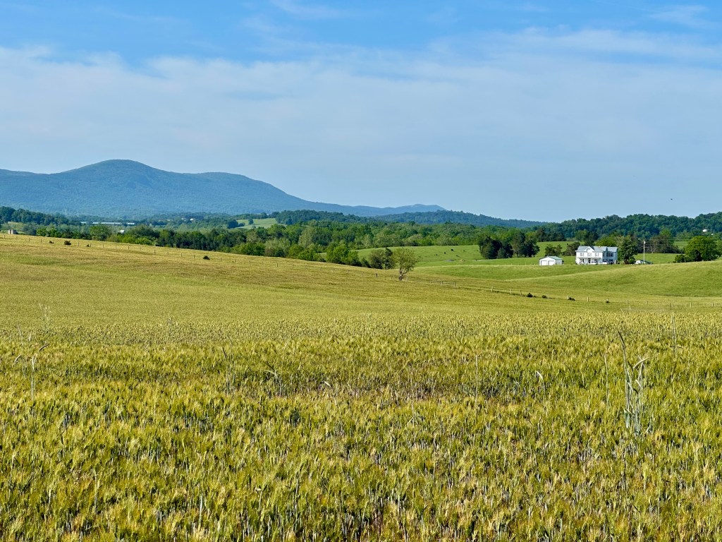
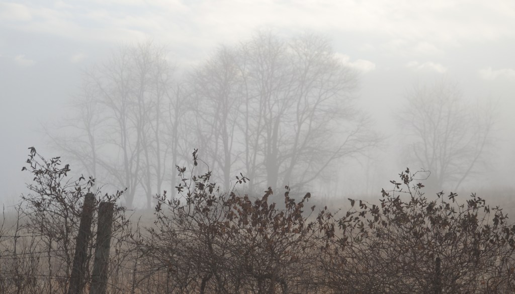
A farm field in Rockingham County, Virginia. Photo by Bruce Stambaugh
It was a foggy morning to go birding. But this wasn’t any bird I sought.
For several weeks, a Crested Caracara, a bird common in Florida and Texas, had been seen off and on in the Broadway, Virginia, area. That was only a dozen miles from my home.
It wasn’t the first time I had tried for the bird. Then, it had flown off shortly before I arrived, where the Caracara had been spotted on more than one occasion.
I waited and waited, thinking the bird would return after the fog lifted. But it wasn’t to be.
While I had waited, however, I took a few photos of the landscape enveloped by the morning mist. The photo above shows both the fog and where the Caracara liked to perch.
The roadside fencerow in the foreground gave depth to the fog-enshrouded treeline in the background. I was happy with the image, even without my target bird.









You must be logged in to post a comment.