Severe weather grips me. As a volunteer severe weather spotter for the National Weather Service office in Cleveland, I pay close attention to the weather forecasts. When the potential for severe weather is a possibility, I go on a personal high alert.
I watch radars. I read online weather maps. And I scan the sky. I also take my camera with me.
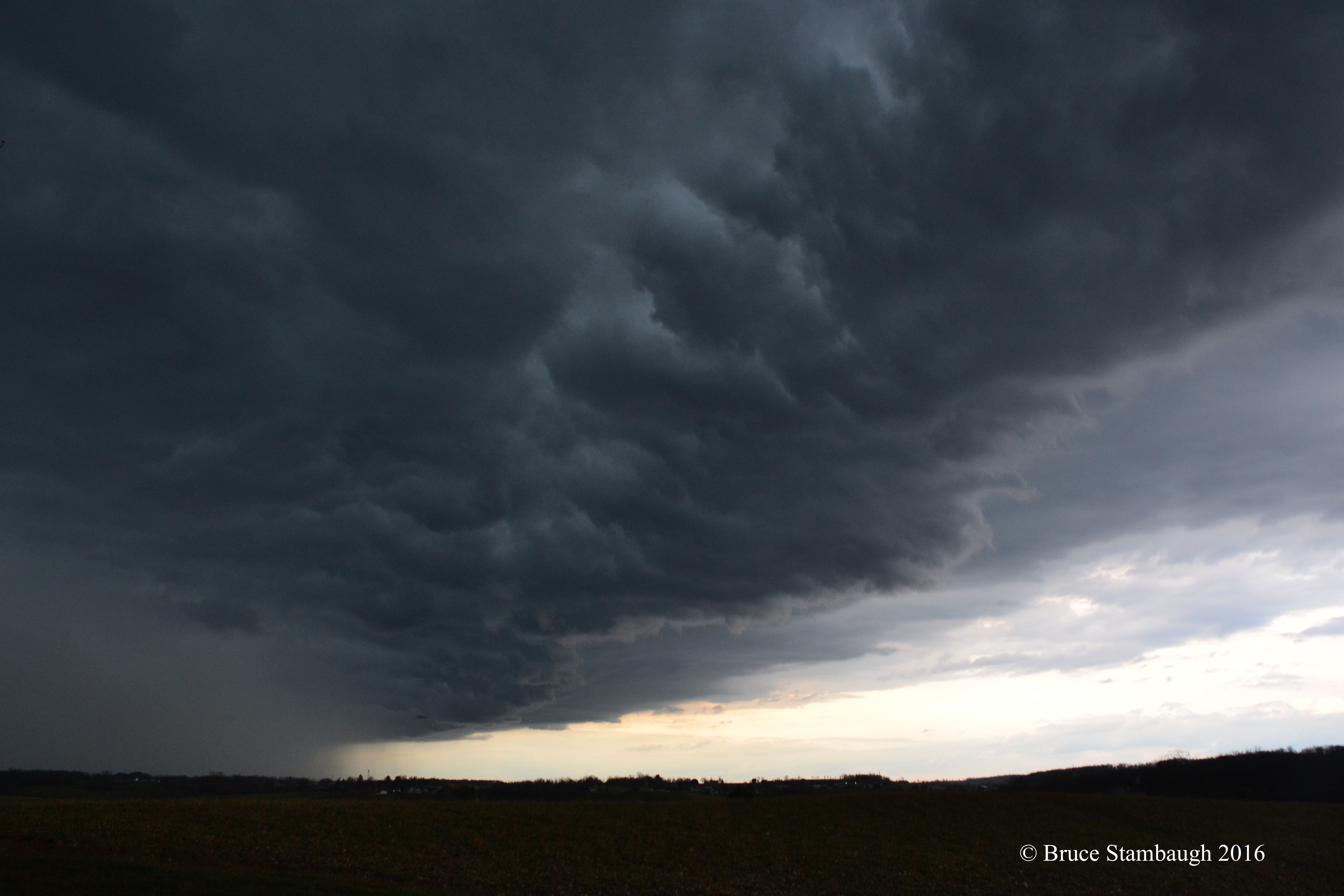
When the season’s first strong thunderstorms approached Monday evening, I was ready. An active weather system had produced a tornado in southwestern Ohio. The cold front weakened a bit as it approached eastern Ohio. But that didn’t keep it from producing some impressive clouds, particularly in the front of the storm system.
The western sky turned dark. I went to the back porch to see what was coming, and this is what I saw looking north. The clouds looked fierce and angry. But fortunately, we only received torrential rains and a few strikes of lightning.
“The Storm Cometh” is my Photo of the Week.
© Bruce Stambaugh 206

Very scary system! Pleased you and Neva were safe. Gail
LikeLiked by 1 person
Thanks, Gail. It look worst than what it was.
Bruce
LikeLike
Fantastic capture!
LikeLiked by 1 person
Thank you, Lemony.
Bruce
LikeLike
I encountered some of these clouds on the way home from work. Did not realize until later they had produced a tornado spotting. Very dark indeed!
LikeLiked by 1 person
I’m fascinated with severe weather, too! I admire people who can photograph it! I follow several weather photographers on Instagram. Fascinating! Great photo!
LikeLiked by 1 person
Thank you.
LikeLike